Take the JR Joban Line out of Tokyo Station, change at Tsuchiura, and you can be on the Ring Ring Road in under 70 minutes, bike rolling, signs in English, the whole 180 km network laid out in front of you. That’s the single most useful thing to know about this route. Most foreign cyclists fly past it on their way to Shimanami Kaido, 700 km southwest, then come back grumbling about the cost. The Ring Ring Road is the same Japan a fraction of the distance from Tokyo, and the riding is easier.
Officially the Tsukuba Kasumigaura Ring Ring Road runs about 180 km in a fat figure-eight: a 40 km former railway path heading northwest from Tsuchiura to Iwase, plus the full perimeter of Lake Kasumigaura, plus a connector southeast to Itako. It got National Cycle Route status in November 2019, the same week as Biwaichi and the Shimanami Kaido. About 110,000 cyclists ride some part of it each year, by Ibaraki Prefecture’s count, and almost all of them are Japanese.
That last part matters. You won’t queue for ferries. You won’t share the path with rental tandems three abreast. The shops won’t have English menus, but they also won’t have foreigner pricing.
In This Article
- The route at a glance
- Why I keep coming back to this one over Shimanami
- Tsuchiura, the only sensible base
- Bike rentals at Tsuchiura
- The old railway course: Tsuchiura to Iwase
- Things actually worth stopping for on the railway course
- Iwase, the north end
- The Kasumigaura loop
- The north shore: lotus fields and rural quiet
- The east shore and the bridge call
- The south shore: industry, then prettier countryside
- The Mt Tsukuba hill climb course
- Tsukubasan Shrine and the cable car
- Where to sleep
- Eating along the way
- The east end: Itako, Kashima, Suigo
- The downsides nobody mentions
- Practical answers in one place
- Other routes if this one fits your style
The route at a glance
The network breaks into three rideable courses with different personalities. The numbers come from the official prefectural data and the Japan Tourism Research Institute’s published ride report, not from a press release.
| Course | Distance | Time | Surface | Best for |
|---|---|---|---|---|
| Old Tsukuba Railway path (Tsuchiura–Iwase) | 40 km one way | 2.5–3.5 hr each way | Dedicated bike path, near-perfect tarmac, no cars | First-time visitors. Anyone with kids. People who hate dodging trucks. |
| Kasumigaura full loop | 90 km (with bridge shortcut) or 130 km (full perimeter) | 4.5–7 hr | Mix of dyke-top dedicated path and quiet shore road, with short stretches on busier roads | Riders who want to bag a 100 km day without much climbing. |
| Mt Tsukuba hill climb course | 25 km loop, 11 km climbing | 3–4 hr including breaks | Mountain road, gradients 6–10%+ in places, traffic mostly tame | Anyone who actually came for hills. Skip if you came to spin past lakes. |
The total elevation gain across the whole 180 km network, if you somehow rode every metre of it, is about 58 m on the flat sections plus around 500 m if you tack on the Mt Tsukuba climb. That’s the entire profile. Read it again if you live anywhere with hills: this is properly flat country.
Why I keep coming back to this one over Shimanami
I’ve ridden Shimanami Kaido three times. It’s the better postcard. But for a quick weekend out of Tokyo it’s an absurd amount of travel: bullet train to Fukuyama, local train to Onomichi, hotel for night one, ride day two, fly back from Hiroshima. The Ring Ring Road is the rare Japanese cycle route you can leave home Saturday morning, ride a respectable century, and be back in your apartment for dinner Sunday.
The other thing it has on Shimanami: the path is actually flat. Shimanami’s seven bridges all carry climbs of 30–65 m, which adds up over a long day. The Ring Ring Road’s railway course is the leftover trackbed of a freight railway. Those engineers were trying to get coal trains over a divide, not show off; the gradient drifts up about 1% over 40 km going north. You’ll never notice it.
Shimanami’s edge is the bridges, the open sea, the islands. The Ring Ring Road’s edge is convenience plus the fact that nobody else is here. If you’ve already done the Shimanami Kaido and want to try a quieter route, this is the obvious next one.
Tsuchiura, the only sensible base
Iwase, at the north end of the railway path, is on a single-track local line that runs roughly hourly. Itako, at the eastern tip of the lake, is a sleepy waterway town with one decent hotel. Both can be done as start points. Don’t bother. You want Tsuchiura.
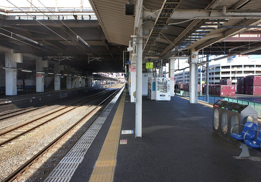
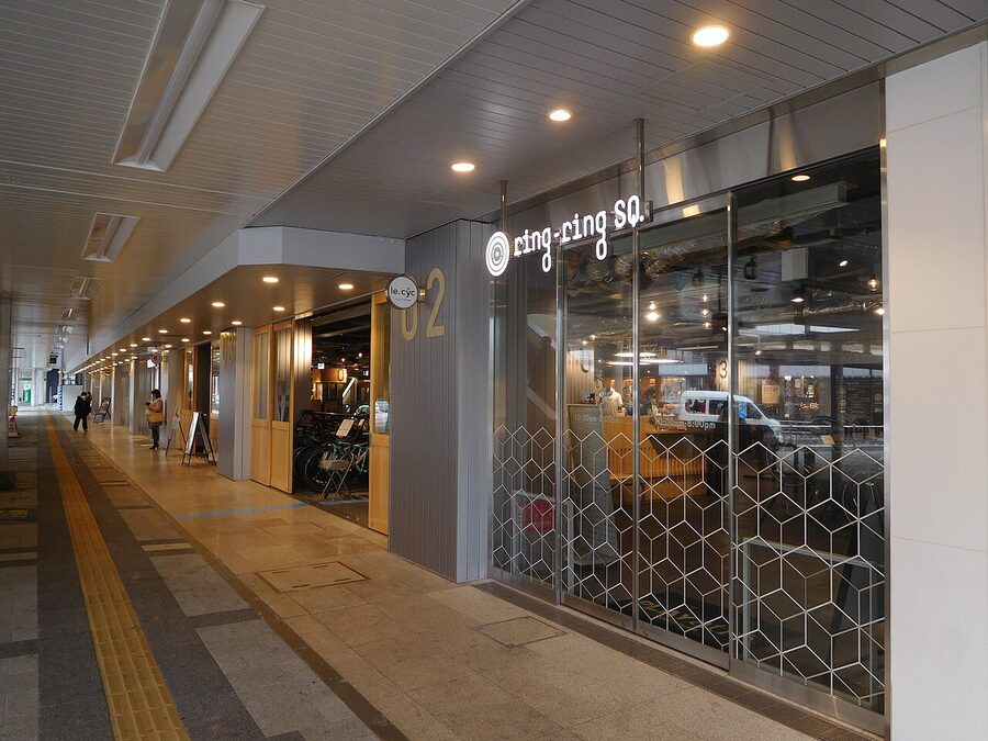
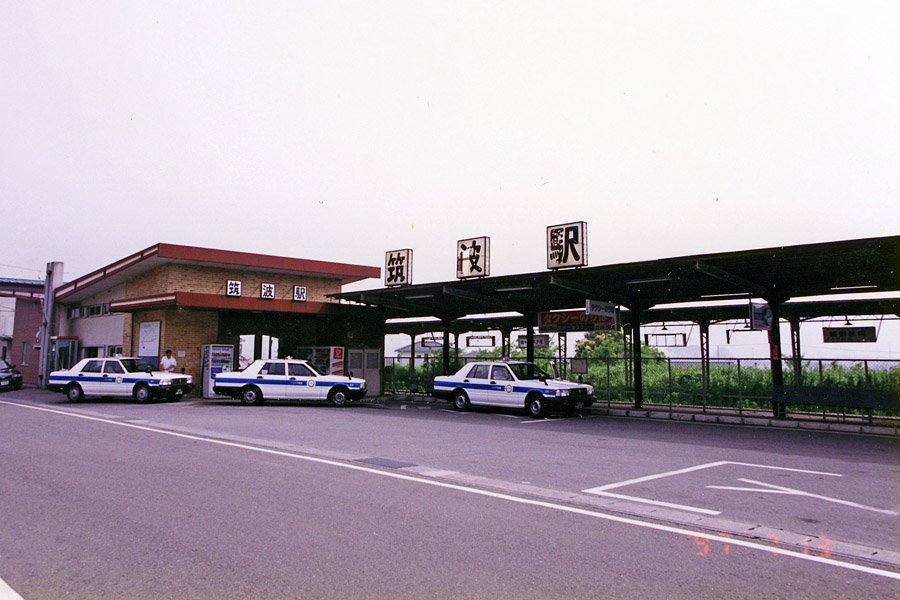
Tsuchiura has been hammered into shape as Japan’s most cyclist-friendly station, and they aren’t lying about it. The whole concourse is set up to let you assemble your bike, push it through the building, and ride straight onto the path. There’s a dedicated bike-assembly area near the ticket gate. The corridor through the station has a painted blue line you can walk your bike along. Some shops on the ground floor will let you wheel your bike inside. I’m not aware of any other JR station in the country where you can do this.
The hotel inside Playatre Tsuchiura, Hoshino Resorts BEB5 Tsuchiura, has rooms where you can wheel the bike onto a wall rack inside the room. It’s a fashion play more than a serious cyclist refuge (the rooms are bunk-bed bohemian rather than business-traveller plain) but the convenience is real. Rates run roughly ¥9,000–14,000 per person per night depending on season.
Bike rentals at Tsuchiura
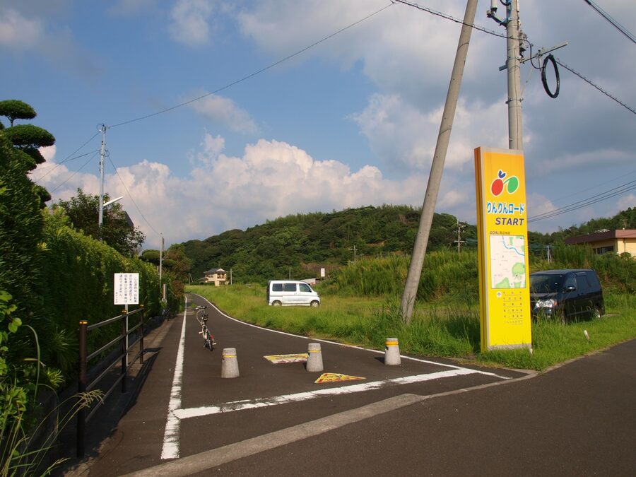
Ring Ring Square Tsuchiura is the rental hub, on the underground floor of the station building. Reserve online via Lecyc, the prefectural booking system, before you go. Weekends sell out, and walking up at 09:00 on a Saturday in spring is a guaranteed disappointment. The 2026 prices are:
- E-bikes: ¥4,500 per day
- Road bikes / mountain bikes: ¥3,500 per day
- Cross bikes: ¥3,000 per day
- City bikes: ¥2,000 per day
- Helmets, gloves, and panniers: extra, also at the counter
You’ll need to leave a ¥1,000 deposit when you collect, refunded on return. Bikes have to be back by 19:30 the same day. The system also lets you drop off at any of 11 other locations around the network: useful in theory for a one-way ride, in practice often blocked by limited bike availability at the drop-off side. The one-way option has been unreliable in practice — recent foreign-rider reports describe being forced into out-and-backs because the drop-off bikes weren’t available. Lock in your accommodation only after the bike reservation is confirmed.
The other rental option in town is Hello Cycling at the underground bike park, which uses a phone app (Japanese only) and charges ¥200 per 15 minutes up to a maximum of ¥3,000 for 24 hours. No reservations, multiple-day rentals possible, but the bikes are city-style with internal hub gears and not really meant for a 100 km day.
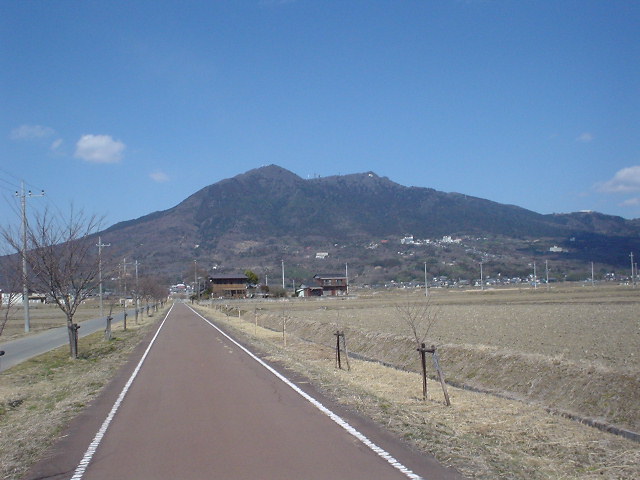
The old railway course: Tsuchiura to Iwase
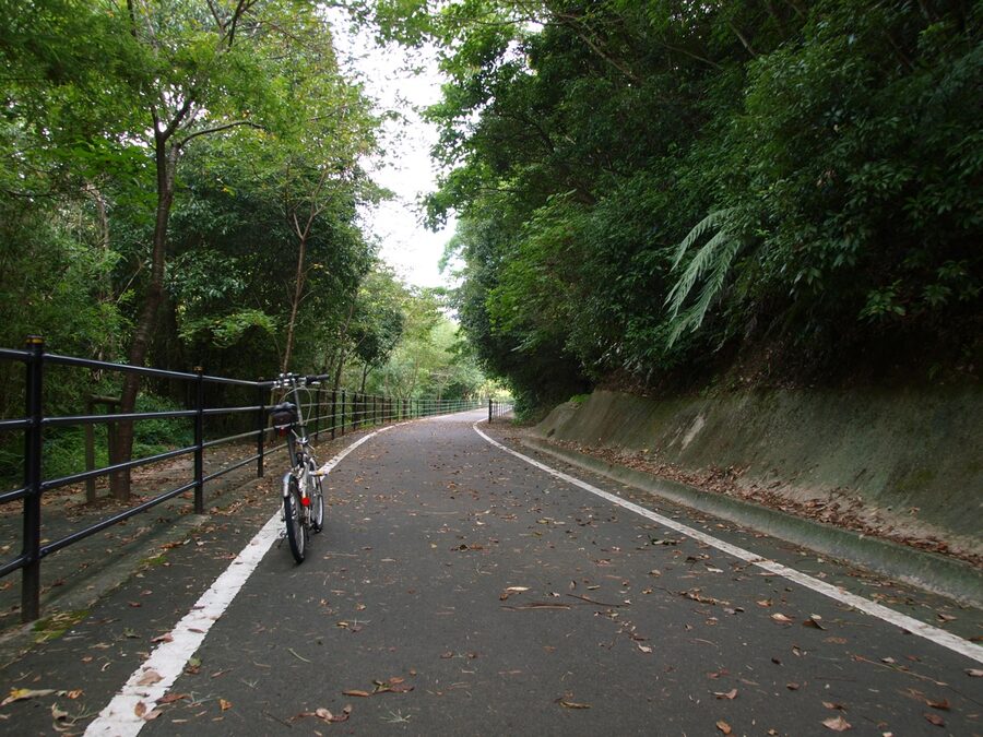
This is the bit you should ride first if you have to pick one. The 40 km route follows the trackbed of the Tsukuba Line, which ran from Tsuchiura up to Iwase between 1918 and 1987. When the railway closed, the prefecture turned the alignment into a dedicated cycling path. Pavement is near-perfect, the line is mostly straight, and there are no cars. Anywhere.
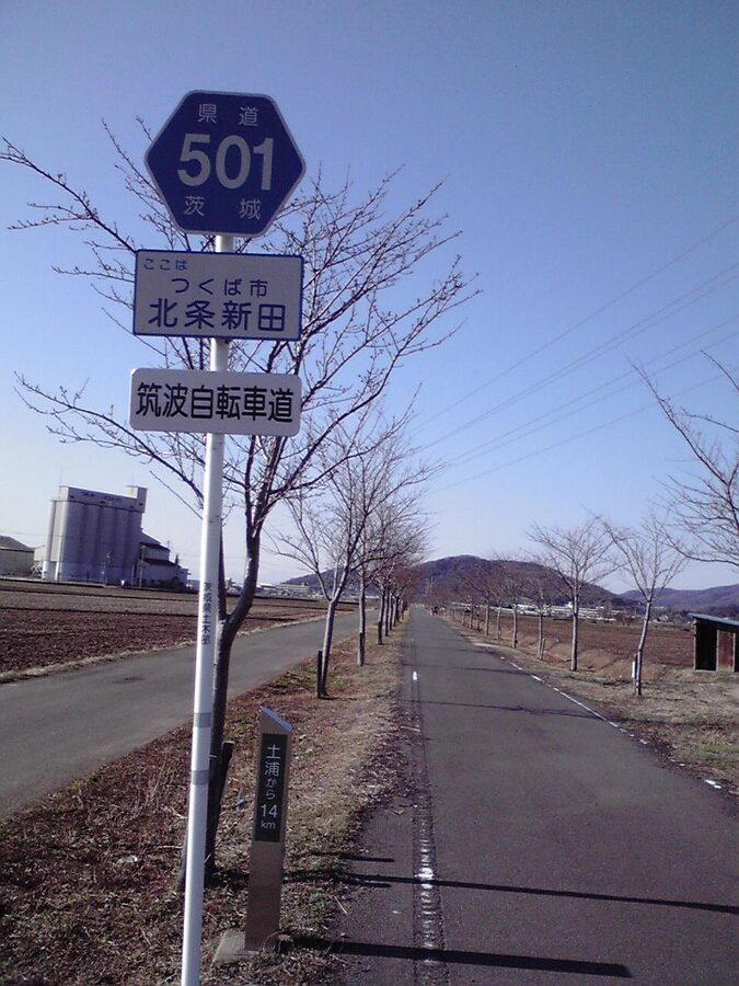
Six former station buildings on the route have been preserved as rest stops. Each has benches, vending machines, toilets, a sycle rack, and most have tyre inflators. They’re spaced 4–5 km apart through Tsuchiura’s sprawl and roughly 10 km apart in open country. If you’re new to long rides, treat each one as a mandatory stop. The structure of the path basically tells you when to drink water.
The path used to have those slalom-gate barriers Japan loves to put on bike paths to slow down mopeds. They were ripped out in 2022 and replaced with single-bike-width chicanes, which are much easier to roll through but still mean you’ll occasionally yield to oncoming riders. Etiquette: the cyclist already in the chicane has the right of way. Otherwise it’s left-side riding, blue arrow markings on the path every 30 m or so showing direction.
Things actually worth stopping for on the railway course
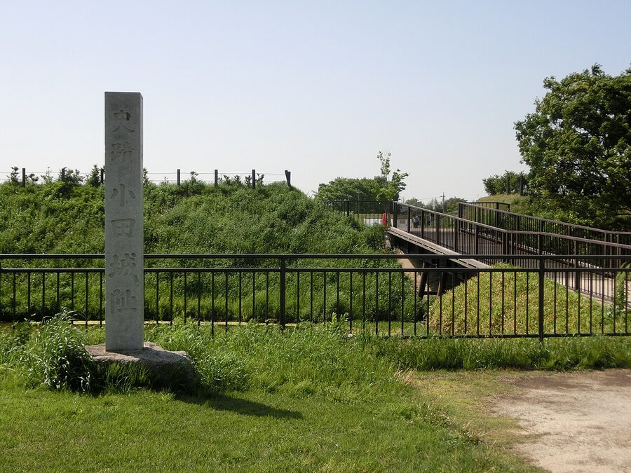
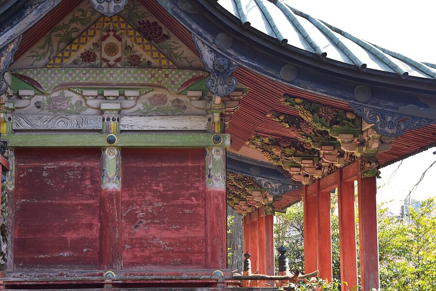
Oda Castle ruins, around 11 km out of Tsuchiura, is the easiest stop on the route. You can roll your bike up the path past the moat, lean it against the rack, and climb the earthworks in five minutes. There’s a free history museum, the Oda Castle Site Information Centre, just off the main path (open 09:00–16:30, closed Mondays). The castle dates to 1185, was held by Hatta Tomoie, one of Yoritomo’s thirteen councillors, and finally fell after Sekigahara in 1602.
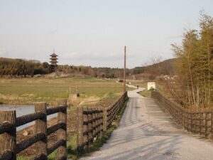
Mt Tsukuba photo spot, Tsukuba City Urushido. Around 18 km out, an officially designated photo platform with a cycle rack sits on the verge. The line of sight runs north-east over a rice field directly to the twin peaks of Mt Tsukuba. It’s the most photographed spot on the path. Don’t be ashamed.
Matsuya Seimensho noodle shop, just past the Tsukubasanguchi rest stop. The proprietor trained at Mensetsu Shichisai, one of Tokyo’s best-known scratch-noodle ramen shops. Matsuya makes its noodles the same way: hand-pressed from the flour upward for each order. The tamagoiri ramen with marinated egg runs about ¥950, open 07:00–17:00, closed Wednesdays. It’s also a manufacturer, so you can buy 2-portion or 5-portion packs of fresh noodles to take home if you have a bag.
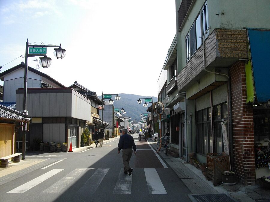
Makabe Old Town, around 28 km up the path. The old Makabe Station rest stop drops you straight into the Edo-era streets. You’re welcome to wander on foot for half an hour while your bike sits at the rack. The Makabe Hina Doll Festival in February and March is the big draw, with about 160 households putting antique hina dolls in their front windows for visitors to see. Off-season the streets are quiet and you can poke into Craft Style, the kimono and yukata textile shop in one of the old warehouses, or eat shaved ice at Kura Cafe Hyoka Fuwari (an Edo-period storehouse converted to a cafe with seasonal natural-ice flavours).
Tsukuba Pudding Fujiya, near Makabe. Cyclist-explicit stop: there’s a cycle rack out front and the parking lot is laid out for it. The Gold Pudding (¥399) uses 25% Okukuji egg yolk, the regional speciality. The Pudding Soft (¥577) is a soft-serve ice cream that sits on top of a pudding, with caramel sauce alongside. Open 10:00–18:00, closed Tuesdays. After 70 km in the saddle it earns its place.
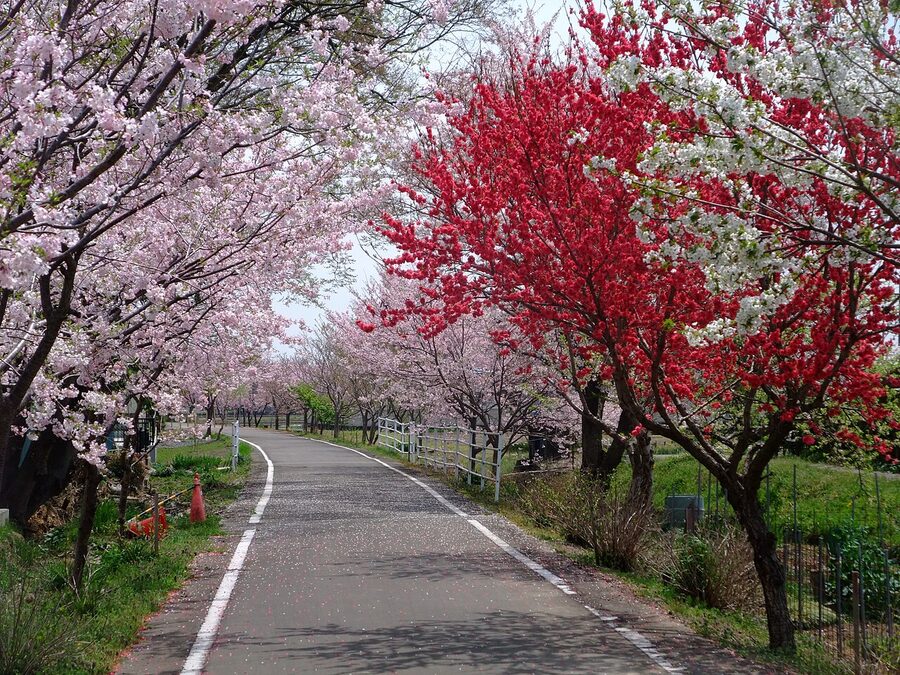
Cherry blossom timing. The standard Someiyoshino along the railway path opens around late March, a week or two after central Tokyo. Yaezakura takes over in early to mid-April, and there are about five Gyoiko trees on the route, a rare green-flowered cherry that blooms with the Yaezakura. So if Tokyo’s bloom has finished and you missed it, get on the train and try the Ring Ring Road. You will not have missed it here.
Iwase, the north end
Iwase Station is at the very end of the path, sat on JR’s Mito Line. Trains run about hourly to Mito or southwest to Oyama on the Tohoku Shinkansen line. If you’ve taken a rental and want to drop it at Iwase rather than ride back, this is theoretically possible, but see the rental availability caveat above. The Iwase rest stop has the basic kit (toilets, vending machines, tyre pump). The town itself is unremarkable.
The Kasumigaura loop
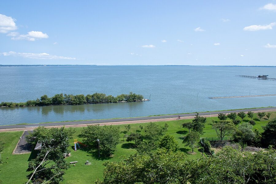
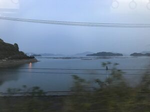
This is the long one. Lake Kasumigaura is the second-largest in Japan after Lake Biwa, but you’d never guess that from the surroundings: the water is shallow (averages 4 m), the shoreline is flat, and the whole basin sits at sea level. Compared to the railway course, the lake loop is rougher around the edges. There are mile-long stretches of dedicated path on top of the dyke, then short interruptions where you have to dive inland on country roads to skirt around an industrial area or a fishing harbour.
Two ways to ride it. The full perimeter is roughly 130 km. The shortcut, taken across the Kasumigaura Bridge that cuts off the northeast lobe, is about 90 km. Cycle Japan’s prefectural site officially calls the 90 km option pucchi-ichi (small loop) and the 130 km the full thing. Decide before you start. Once you’re on the path the headwind takes the decision out of your hands.
I’d go anti-clockwise from Tsuchiura. North on the dyke first, then east, then back along the south shore. The reason: the prevailing wind in spring and autumn is south-southwest, so you eat headwind early when your legs are fresh and finish with a tailwind home. It also means Mt Tsukuba is over your right shoulder for most of the ride, which is the better view to have when you stop for a photo. Counterclockwise also gives you better sightlines on the second half.
The north shore: lotus fields and rural quiet
Out of Tsuchiura you cross the railway tracks on a footbridge and follow the road north along the lake. The first couple of kilometres are alongside a busier road, and Japanese cyclists tend to ride the wide pavement here rather than the bike lane on the carriageway. That’s what I’d suggest too. After 1.5 km the path peels off onto a back road behind the baseball stadium and you’re on the dyke proper.
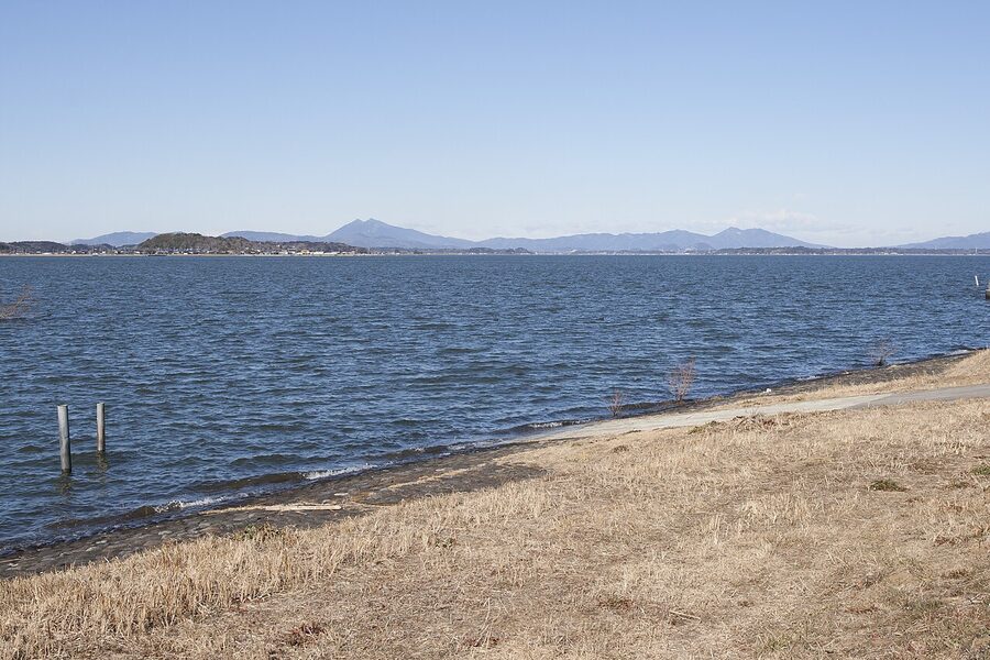
The first 20 km is the prettiest stretch. Lake on your right, lotus fields on your left, occasional pickup trucks driving the dyke as a service road but otherwise a peaceful ride. The lotus is the local cash crop. The Kasumigaura basin grows about half of Japan’s lotus root, which is why the shoreline reads like an inland Vietnam. The harvest is November to March, and you’ll see farmers in chest-high drysuits using high-pressure hoses to wash the roots out of the mud. October is when the dead stalks are still standing and the new flooding starts. July is bloom time. Pictures from any other month look the same: muddy.
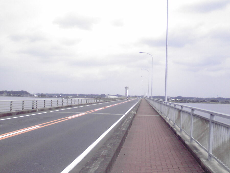
About 22 km out is the Kasumigaura Bridge crossing, decision point for the short or long loop. Just past it is a small lakeside cafe (no name visible from the path) — the sweet potato with ice cream is the order I cannot improve on.
The east shore and the bridge call
If you take the bridge, you cross to the south side and pick up the path again on the opposite shore. The 90 km is the better choice for another reason: the northeast arm of the lake bumps into a cement plant and the path spends a few kilometres on a road shoulder with truck traffic. Skipping that section is not a loss.
If you go the full distance, the northeast arm is empty in the best sense. There’s basically nothing for 25 km but one or two convenience stores set back from the path. You will need to plan: top up water and snacks at the konbini in Takahama before committing, because once you’re round the top end of the lake you’re committed for at least 90 minutes.
The south shore: industry, then prettier countryside
The south shore is the rougher half. There are two industrial detours where the path leaves the lake to skirt round factories and cement plants, and a 4 km section that follows a busy national road shoulder. There’s a marked cycle lane in most places, but not everywhere. If you’re nervous in traffic, this stretch will not be your favourite.
The reward is the southwestern stretch, the run from Ayumizaki Park back towards Tsuchiura. The Kasumigaura Exchange Centre at Ayumizaki has the best food on the entire loop. Kasumi Kitchen, on the second floor, does set lunches with Hitachi-gyu beef, fresh-caught lake catfish, and lotus root prepared four ways. Lunch with rice and miso runs ¥1,500–2,200. There’s also a footbath outside (free) and showers and changing rooms upstairs (¥200) for the cyclist who’s been on the bike for five hours. Closed Wednesdays.
The Mt Tsukuba hill climb course
This is the optional extra. The hill climb course branches off the railway path about 15 km north of Tsuchiura, climbs the southern face of Mt Tsukuba via Fudo Pass, and descends again to rejoin the path near Hojo Pond. It’s a 25 km loop with about 11 km of climbing and 500 m of total elevation gain.
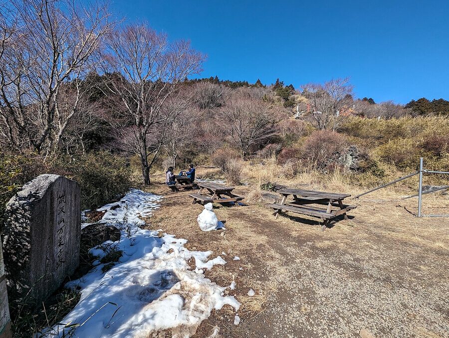
The climb averages a touch under 5%, which sounds gentle on paper. It isn’t. Mt Tsukuba is one of those mountains where the road kicks up to 8% and 10% in the steeper sections and lets up briefly along the ridge, so the actual perceived gradient is more punishing than the math. There’s also one segment past the Tsukuba Skyline junction where you cross a busy road with no light. Keep your wits about you.
Markers at every hairpin tell you the curve number, distance to the top, and elevation gained. It’s the kind of detail somebody who actually rode this designed in. There’s no real reason to do this climb unless you actively enjoy hill climbing. The descent rewards you, but the railway course is what makes the area interesting. Skip the climb if you came for the lakes; do it if you came specifically for hills.
Tsukubasan Shrine and the cable car
The shrine is at the base of the climb, before things get steep. Most cyclists stop in for water and a quick bow at the haiden. There’s a cable car from the shrine area up to the saddle between the twin peaks, then a chairlift to the summit, if you want to skip the climb but still get the view. Cable car runs every 20 minutes, ¥1,100 return for adults. You can also lock up the bike at the cable car station and walk it; the trail to the summit takes about two hours.
Where to sleep
The cyclist-friendly inn certification (sairipu shouhin in Japanese) is real and useful: certified properties have a covered bike storage area, an in-house repair stand or pump, and laundry that runs the same evening. The official prefectural site lists about thirty certified inns. The ones I’d actually recommend:
Hoshino Resorts BEB5 Tsuchiura. Inside Playatre at JR Tsuchiura. Rooms with bike racks on the wall, repair area on each floor, breakfast cafe runs from 06:30. From around ¥9,000 per person twin. The least Japanese-feeling option but unbeatable for logistics: you literally never leave the station building. Booking platforms list it directly: Booking.com, official site.
Inashiki Nest. Renovated farmhouse on the south shore of Lake Kasumigaura, about halfway round the lake from Tsuchiura. Five guest rooms, dinner cooked by the family on request, secure bike parking. About ¥9,800 per person with breakfast. The location splits the lake loop neatly into two days. Check availability via Booking.com.
Tsukubasan Edoya. Mid-budget ryokan at the base of Mt Tsukuba, useful if you’re combining the railway path with the hill climb course. Hot spring bath, kaiseki dinner, secure storage. From around ¥15,000 per person with two meals. Good for a “ride from Tsuchiura, hill climb, ryokan night, ride back to Tokyo” weekend.
Eguchiya Guesthouse. Renovated traditional farmhouse near Ayumizaki Park on the south shore. About ¥12,000 per person with breakfast, popular with Tokyo couples and books out fast. Edo-style rooms, family-cooked dinner, owner remembers the cyclist guests. Reservations via Eguchiya’s own site or direct phone. Not on the major OTAs at the time of writing.
If you want a longer trip and have time to detour, the historic waterway town of the Tobishima Kaido in Hiroshima is a different feel of the same flat-coastal-Japan archetype, and worth pairing with this route if you’re already over for several days.
Eating along the way
Outside the named places above, the lake loop has very few cafes or restaurants. Plan to use convenience stores. The 7-Eleven and Lawson at Takahama on the north shore, at the Kasumigaura Bridge approach, and at the Itako waterfront are the three you’ll definitely use if you do the full perimeter. Carry one extra bottle of water than you think you need; on a still day the lake-top heat builds quickly.
On the railway course you do better. As well as Matsuya Seimensho ramen and Tsukuba Pudding Fujiya covered above:
- Hill Climb cyclist cafe near Hojo Pond, halfway up the railway path before the climb branches off. Sets ¥1,200–1,500, vegetable-heavy, named for the climb course.
- Yamato Soba at the foot of Mt Tsukuba in Tsukubasanguchi, family-run buckwheat soba, ¥850 for tempura zaru.
- Kura Cafe Hyoka Fuwari in Makabe, shaved ice with seasonal fruit syrups, ¥1,300–1,800. Fans tell me the Iris flavour (lemon-milk syrup with butterfly pea tea) is worth ordering even if you’d normally stick to strawberry.
The east end: Itako, Kashima, Suigo
The official Ring Ring Road network keeps going east from the Kasumigaura loop, connecting through Itako (waterway town, famous for irises) and on to Kashima Jingu, one of the three big shrines of the eastern provinces. The path on this section is less developed (you’re mostly on quiet country roads with road markings rather than dedicated cycle paths) but for a multi-day rider it’s a worthwhile add-on.
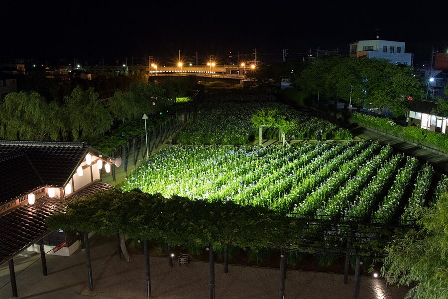
Itako sits on a network of canals that used to run cargo to Edo-era Tokyo; some of the houses still have boat slips at the back. The Iris Festival in June is the headline event; off-season the town is empty in a pleasant way. There’s a cyclist-friendly Michi-no-Eki rest stop at Itako with toilets, food, and the canal-boat dock 200 m away.
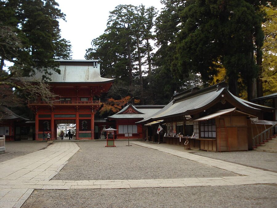
Kashima Jingu is another 25 km east, across the prefectural boundary into Kashima City. The shrine grounds are old-growth forest with deer wandering the paths and a sword dance hall in the centre. It’s properly atmospheric. You can ride the Kashima route from Itako and back in a day, then take the train back from Kashima Jingu Station.
The downsides nobody mentions
The Ring Ring Road has rough edges. They aren’t dealbreakers, but they’re real.
The lake’s south shore is dull in places. About 8 km of the south side of the Kasumigaura loop runs alongside an industrial belt with cement works and chemical factories. The path skirts inland, so you’re not riding through them, but the views are aggressively unscenic. The first time I rode it I’d have skipped that section if I could. The Kasumigaura Bridge shortcut neatly removes the worst part if you take the 90 km option.
The lake gets ridiculously windy. The basin has nothing to break the wind, and the dyke top is exposed. A 15 km/h wind that you’d ignore in central Japan turns into a relentless headwind for 30 km on the lake. Check the forecast. If the prediction is for sustained 6 m/s or more, do the railway course instead.
Bike availability is unreliable. The widely-marketed point-to-point rental system, where you can drop a rental at any of 11 locations, runs into reality at the supply end. Editorial trip reports note that bikes regularly aren’t available where you want to drop them, leaving you to ride back where you started. Plan an out-and-back as the safe option, treat point-to-point as a bonus.
Trains will not take your bike fully assembled. Like everywhere in Japan, you have to bag the bike (rinko) to take it on the train back. There’s a single specific JR limited express running from Ueno on weekends that allows assembled bikes (reservation only, Japanese-language booking system). Otherwise: rinko bag, partial disassembly. Tsuchiura Station has the bike-assembly area for this exact reason; Iwase does not. If you ride one-way to Iwase you bag the bike on the platform.
Path quality on the east end is not great. The Itako and Kashima sections were added later and are mostly road markings on shared roads rather than dedicated cycle paths. Manageable but not the same experience as the railway course.
Summer is brutal. July and August on the Kanto plain run 32–37°C with high humidity. The lake adds reflected heat from the water. There’s almost no shade on the dyke. Spring (cherry blossoms) and autumn (rice harvest) are the right windows. Winter is fine if you have layers, but the path is frosty before 09:00 and the official guidance is to mind ice on the dyke.
Practical answers in one place
For first-time questions on visa-free cycling, train rules, road etiquette, and weather windows, see our cycling-Japan FAQ. The route-specific bits below are the ones particular to the Ring Ring Road.
How fit do I need to be? The 40 km railway course one way is doable for any reasonably active adult on a city bike, in maybe 3 hours one-way. The 90 km Kasumigaura loop is a comfortable day for someone who rides 30–50 km on a Saturday at home; the 130 km full loop wants someone who’s done a 100 km day before.
Best time of year? Late March to early May (cherry blossom and shoulder spring) and late September to early November (autumn rice harvest, lotus harvest, mild temperatures). November mornings are crisp but the air is glass-clear. If you want the best Mt Tsukuba photos, this is the window.
Do I need to speak Japanese? No. Tsuchiura’s signage is bilingual. The rental booking system at Lecyc has English-language option. Konbini and the cafes I’ve named don’t require any Japanese. Once you’re past the railway path’s first 25 km though, English starts to thin out. The Hello Cycling app is Japanese-only.
Can I do this with kids? The railway path: yes, easily. There are trail-a-bike adapters and kids’ cross bikes available for hire. The lake loop: only with a teenager who’s done long rides before. The hill climb: no.
What about wet weather? Both the railway course and the lake’s dyke-top sections have nowhere to shelter. The path drains well so it’s not a swamp after rain, but a steady rain for the day is unpleasant in a way the Shimanami Kaido isn’t (where each bridge has a covered approach). Pick a different weekend if the forecast is for rain.
Other routes if this one fits your style
If you like the flat-and-easy character of the Ring Ring Road, the obvious next ones in the network are Biwaichi around Lake Biwa (same lake-loop concept but twice the distance and proper mountain views) and the lesser-known Kibi-no-michi in Okayama, a 17 km former rail-trail through ancient capital sites that’s similar in feel to the railway course here. For Setouchi sea-and-island riding the original is Shimanami Kaido; the quiet alternative one bay over is Sazanami Kaido. If you want a route with weight of history and the roads the daimyo travelled, the Tokaido between Tokyo and Kyoto is the long-distance option. And if you fancy a flat 150 km loop with sea views and a big bridge thrown in, Awaichi around Awaji Island sits at the same difficulty as Kasumigaura but with ocean. Lesser-known but in the same class as the Ring Ring is the Keinawa Cycling Road from Kyoto to Wakayama, another inland route most foreign cyclists never hear about.