Sixty-six thousand five hundred yen. That’s what one careful Japanese cyclist spent riding from Kyoto to Tokyo over seven days in April: ¥16,000 on transport, ¥41,500 on lodging, ¥9,000 on food, every receipt added up. The same trip booked through RAID Cycling‘s eight-day luxury Tokyo-to-Kyoto package costs around ¥1,020,000 per person. That’s the spread you’re picking from. One end of it is roughly ¥10,000 a day for a self-supported rider sleeping in business hotels and eating katsudon at chain restaurants. The other end is hand-picked kaiseki dinners, a four-person Japanese support crew, and luggage transferred between ryokan while you spin into them in cycling kit. Both versions exist. Neither is wrong. The point is to know which one you’re buying before you start, because almost every choice on this route comes back to that gap.
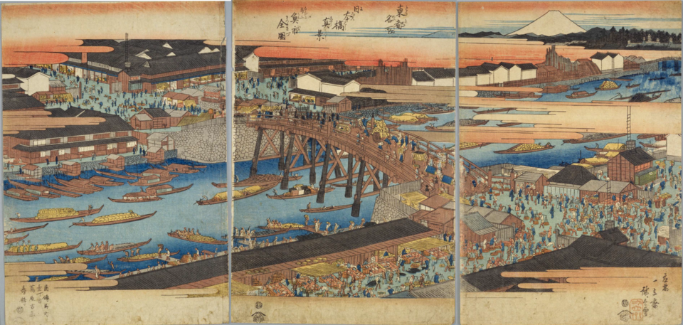
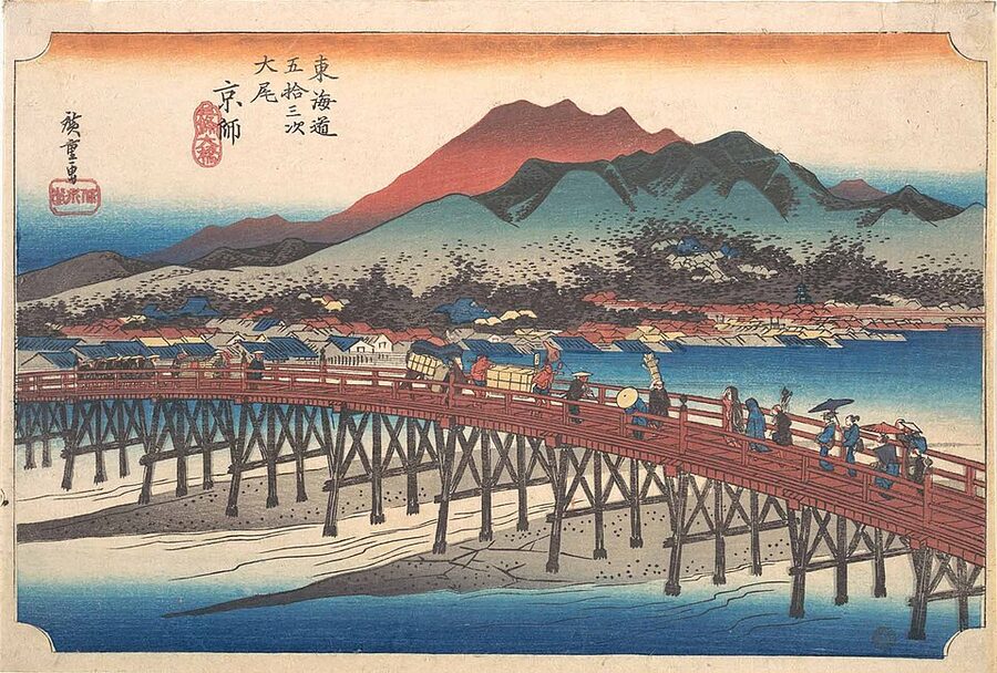
The road itself is the Tōkaidō, the eastern sea route the Tokugawa shogunate formalised in 1601. It linked Edo (now Tokyo) and the imperial capital at Kyoto via 53 designated post stations: the famous gojūsan-tsugi Hiroshige immortalised in his 1833 woodblock series. Before bridges, before railways, before the bullet train, this was the artery. The fastest couriers, the hikyaku, are reputed to have run the whole 500-odd kilometres in three or four days, hand-delivering urgent letters from castle town to castle town. Today’s Route 1 highway tracks most of the same line. You can ride the Tōkaidō. The interesting question is whether you should.
In This Article
- What you actually get for the money
- The route, station by station: what’s actually there
- Tokyo to Odawara: getting out of the city
- Odawara to Mishima: Hakone Pass
- Numazu to Hamamatsu: the bypass minefield
- Hamamatsu to Nagoya: the unloved middle
- Yokkaichi to Lake Biwa: Suzuka Pass
- The last 10 km into Kyoto
- Six days, seven days, ten days: planning the daily distances
- Suggested 7-day breakdown
- Bikes, gear, and the question of riding your own
- What to eat (and where the ¥500 lunches are)
- When to ride: the season call
- The negatives, and who shouldn’t do this ride
- Train + bike: the bailout option
- Maps, books, navigation
- Where to sleep: practical accommodation by stop
- Differentiating notes from other long-distance Japan routes
- The Yaji-Kita question
- One last thing: the bullet train ride home
What you actually get for the money
I want to put the value question front and centre, because it shapes everything else: route choice, gear choice, where you sleep. Here’s the comparison.
| Approach | Total cost | Days | Daily km | What you get |
|---|---|---|---|---|
| Self-supported, business hotels | ¥60,000–¥90,000 | 5–7 | 80–110 | Total flexibility, train-and-bike escape if you bonk, ¥5,000 hotel rooms with onsen-side bathrooms, gas station coffee, the actual road as it is |
| Self-supported, ryokan upgrade | ¥120,000–¥180,000 | 6–8 | 70–90 | Two or three nights of kaiseki meals and shared baths, the rest in cheaper hotels, mid-range gear OK |
| Guided premium tour (RAID, ebiketourjapan.jp) | ¥900,000–¥1,200,000 | 8–10 | 60–80 | Support van, mechanic, Japanese-speaking crew, hand-picked ryokan, all meals, English route briefings, no logistics for you |
The cheapest version isn’t actually cheap, by Japanese standards. A five-day rental from Tokyo Cycling Tour & Rental runs about ¥13,000 including a rinko bag for the bullet train home. Add ¥7,000 a night for business hotels in Hakone, Shizuoka, Kakegawa, and Nagoya, plus food and trains, and you land somewhere around ¥65,000–80,000 if nothing breaks. Hakone-Yumoto onsen rooms run ¥11,814 (with a small ¥150 onsen tax) at the cheap end of the proper-ryokan tier; that’s the most you’ll pay on the route. A Toyoko Inn night in Kakegawa is around ¥5,565. Kawasaki sits at ¥7,128 — that’s the one with the room door opening onto an outdoor walkway.
The premium version isn’t really about the riding either. It’s about removing every decision that isn’t pedal-strokes. You don’t navigate. You don’t pick the lunch spot. You don’t argue with a hotel desk about whether the bike can come inside (it can; just ask politely). You don’t pack panniers or boil up plans on the rest day. The road is identical. What changes is what surrounds it.
If you’ve ridden long-distance in another country before, the self-supported path is the better deal. Japan is set up for it: vending machines every kilometre, 7-Elevens with hot food in every village, polite drivers, decent road surfaces. If this is your first multi-day overseas ride and you don’t speak any Japanese, the guided route earns its premium. There’s no honour in white-knuckling a tunnel detour at dusk.
The route, station by station: what’s actually there
The full distance from Nihonbashi to Sanjō Ōhashi runs about 495–535 km depending on how strictly you trace the historic line. The full distance runs about 495–535 km depending on how strictly you trace the historic line, with around 3,374 m of climbing along the National Route 1 spine. A typical seven-day GPS log clocks 495.5 km; the variance is mostly bypass detours and missed turns.
You can think of it as four working sections plus an opening day in greater Tokyo and a closing day along Lake Biwa.
Tokyo to Odawara: getting out of the city
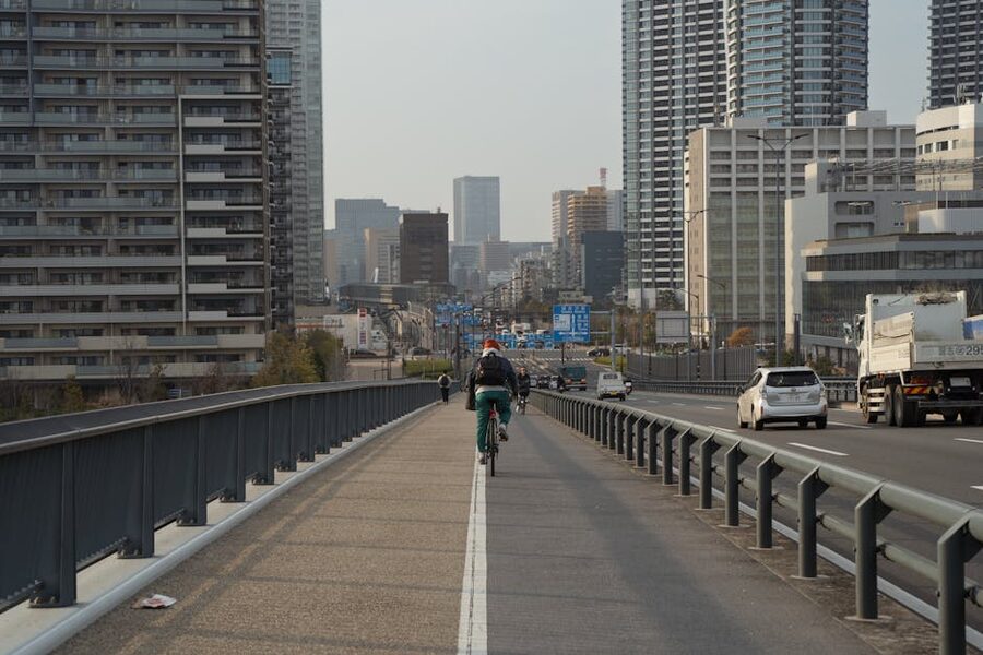
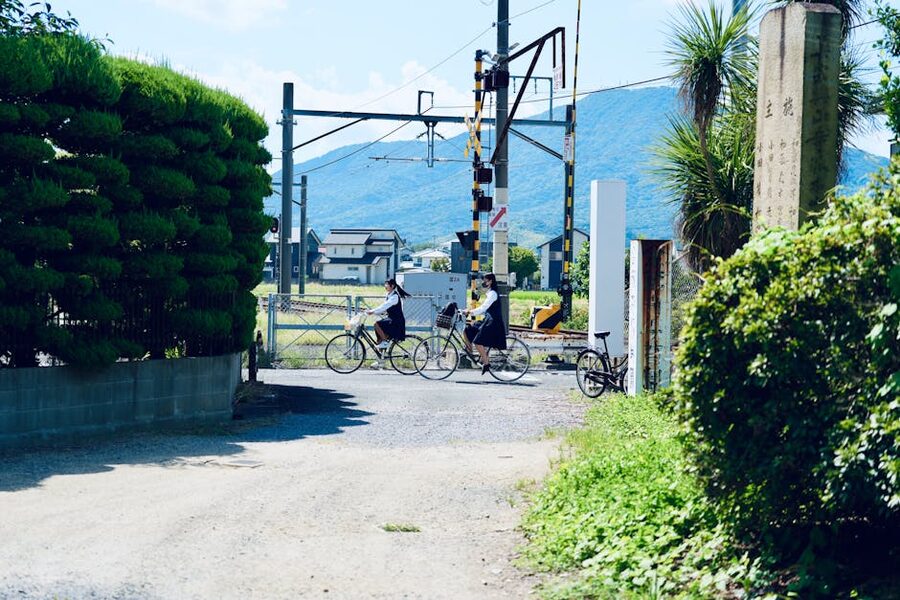
From Nihonbashi you ride south on Route 15, through Shinagawa, Kawasaki, and Yokohama. This is the worst stretch of the whole route. Traffic is heavy, the air is bad, signal lights kill your average speed, and the historic post stations of Shinagawa, Kawasaki, and Hodogaya survive only as small markers and the occasional preserved wooden building. Most riders set off at first light and try to be past Yokohama before commute traffic peaks at 08:00. Setting off from central Tokyo at 05:30 is the pace that works.
By Fujisawa the traffic eases. From Hiratsuka onwards you can pick up sections of the old Tōkaidō kaidō that parallel Route 1 on the inland side. Ōiso has a beautiful surviving stretch of matsunamiki, the old pine avenue planted in the Edo period to give travellers shade. You cross the Tamura River, then the Sakawa, and roll into Odawara around the 80–85 km mark from Nihonbashi. Most riders stop here. There’s no point starting Hakone tired.
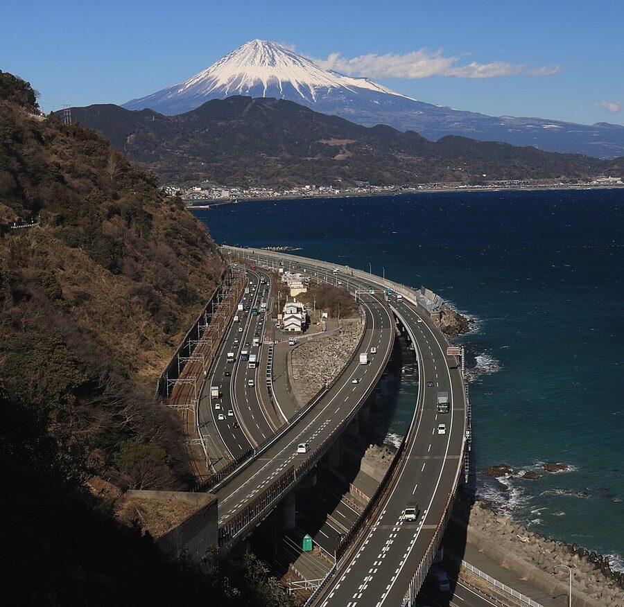
Odawara to Mishima: Hakone Pass
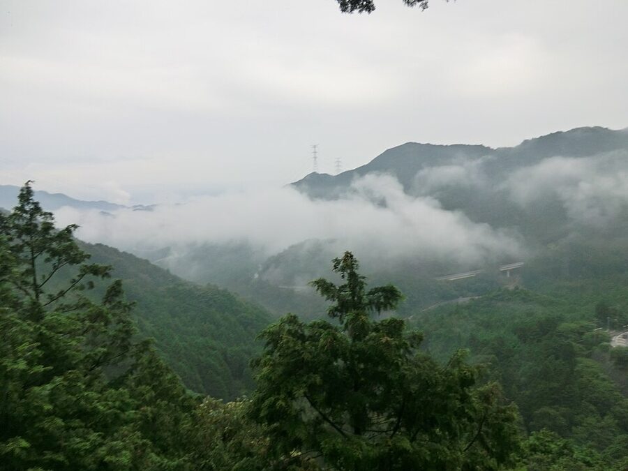
This is the climb everyone warns you about. From Odawara at sea level the old road rises to about 850 m at Hakone Pass before dropping to Mishima. The total ascent is around 800 metres in 15 km, not extreme by alpine standards, but the final kilometre touches a 21% gradient on the eastern side. The 21% sign comes as a punch when you see it. Most cyclists who push through to the summit finish the last 200 m walking. There’s no shame in it.
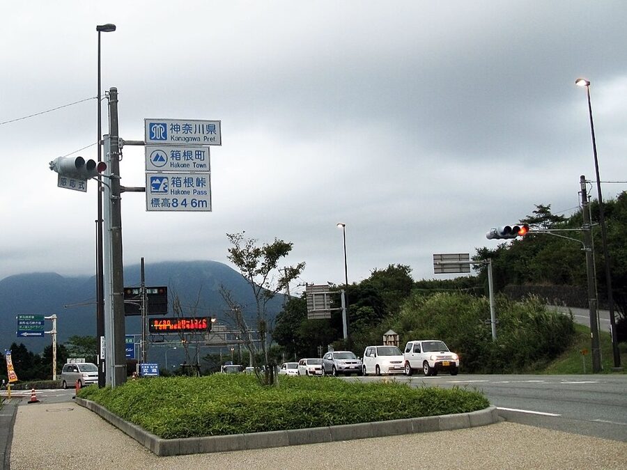
Critical bypass note: the Hakone Shindō expressway diverges from the old road right before Hakone-Yumoto Station. Cyclists are barred from the expressway. You want the narrow road on the right marked “Old Tōkaidō”. The exact junction is critical. Take the wrong fork and you’re inside a tunnel-and-flyover system designed for cars at 80 km/h, with no shoulder and no turn-around. Police will stop you; if they don’t, the trucks will. Get this turn right.
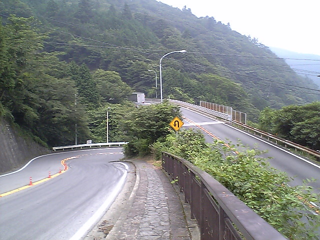
The descent on the Mishima side is worth the climb on its own. The old road snakes through cedar forest, the cars thin out, and at the right time of year (April–May or October–November) the air carries the smell of new pine. On the descent the road is narrow, traffic builds with the morning, and the pavement is rough. The view is spectacular but you can’t sightsee mid-descent. Stop at one of the lay-bys.
For the climb itself, our cycling Japan FAQ covers gearing, train+bike rules for bailout, and what to do if it rains on the pass. Worth a read before you set off.
Numazu to Hamamatsu: the bypass minefield
This is where the route punishes the unprepared. From Numazu through Fuji, Yui, Shizuoka, Fujieda, Kakegawa to Hamamatsu, Route 1 turns into a chain of baipasu: cyclist-prohibited expressway sections that swap into and out of the surface road without obvious warning. What follows are the five bypass names you need to know to get through this stretch without arrest or injury:
- Numazu Bypass. Detour at the Yawata-higashi intersection in Shimizu-cho onto Prefectural Route 380, which is itself the genuine Old Tōkaidō. Easy to miss because the junction looks like a normal traffic light but is actually a flyover.
- Fuji-Yui Bypass. Stay on Route 380 past Yoshiwara, switch to Route 139, then to Route 396 at the Aoshima intersection. The trap is that Route 396 merges back into the bypass at Yui Station. There’s a tiny right turn just before Yui; that’s your exit. Miss it and you’re stuck.
- Shizuoka Bypass. Signposted detour through the city centre. Mostly painless.
- Iwata Bypass. The Tenryū River crossing forces you onto a specific local route. Locals will help if you ask.
- Hamamatsu Bypass. Pretty much unavoidable on the south side; ride the parallel old road through Maisaka.
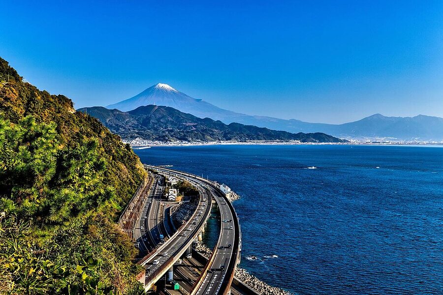
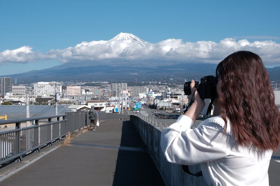
The Yui-Satta detour is the genuine highlight here. You leave Route 1 at Yui and take a one-lane road that climbs about 100 m up the hillside before dropping back to the coast at Okitsu. Halfway up is the lookout where Hiroshige sketched his “Yui” plate, the famous one with Mt Fuji over Suruga Bay and a tiny cluster of travellers picking their way along a clifftop path. The view today is the same composition with extra freight trains. Stop. Take five minutes. This is one of the moments you came for.
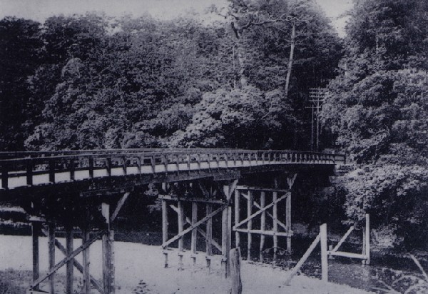
Around the 250 km mark, between Kanaya and Shimada, you cross the Ōigawa River. There’s a 900-metre wooden footbridge called Hōrai-bashi that costs ¥100 to cross and has no railings; locals still ride it on bikes despite the marginal width. It is, unambiguously, scary. It is also the longest wooden bridge of its kind in the world. Cyclists either love it or get off and walk. In the Edo period, before any bridge existed, travellers crossed the river on the shoulders of professional kawagoshi labourers; the Shimada River-Crossing Museum has a wax exhibit of the old workers, half-naked and gripping wooden poles, that is somehow more memorable than most ukiyo-e prints.
Hamamatsu to Nagoya: the unloved middle
This is the worst section, by a margin. Almost everyone who’s ridden the Tōkaidō says the same thing. From Toyohashi west to Nagoya you’re on Route 1 with limited bypass alternatives, fighting truck traffic, breathing diesel, watching the kilometre markers tick up too slowly. Japanese ride reports universally call it “perhaps the least enjoyable section of the whole route”. They’re being polite.
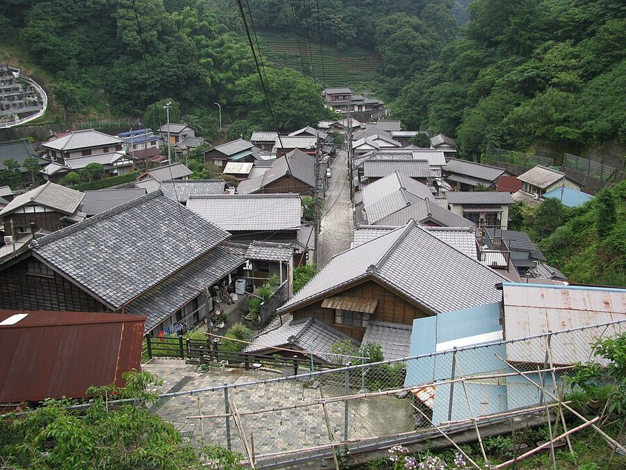
The redeeming detail is Akasaka-juku and Goyu-juku, sister post stations about 4 km apart, joined by a stretch of perfectly preserved pine-tree avenue. Akasaka has the Ōhashiya, a working hatago (traveller’s inn) that has continued in unbroken operation for over 400 years. Hiroshige drew the place; the present building dates from 1837 and it’s still a small ryokan. Mid-week single rooms run around ¥9,000 with breakfast. If you stop here for tea and skip Toyohashi entirely, you’ll have a better day.
Through Nagoya itself, get to Atsuta-jingū shrine and stop for soba. There’s a row of low restaurants near the south gate where the noodles cost ¥850 and come with a small pickle dish. Then plough on. The Tōkaidō exits Nagoya west via Kuwana, where a Tokugawa-era ferry once crossed Ise Bay; today you take Route 1 over the bridges, which are flat and boring but at least short.
Yokkaichi to Lake Biwa: Suzuka Pass
The second pass on the route, after Hakone. Suzuka is gentler, about 360 m at the summit on the cycling line via Route 1, with a long approach. The old Tōkaidō pilgrim path actually goes higher and is mostly a mountain track unsuitable for road bikes. Most riders take Route 1 over Suzuka and make it without walking, even though local wisdom is that it’s tough. The descent into Tsuchiyama-juku on the Shiga Prefecture side is one of the best of the whole route: open road, gentle gradient, rice paddies and small village stations.
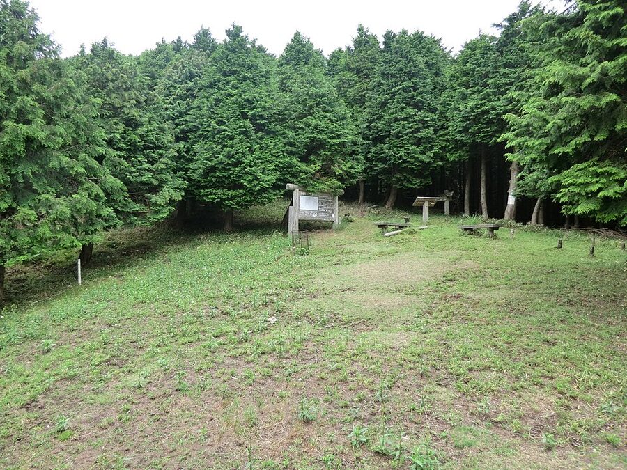
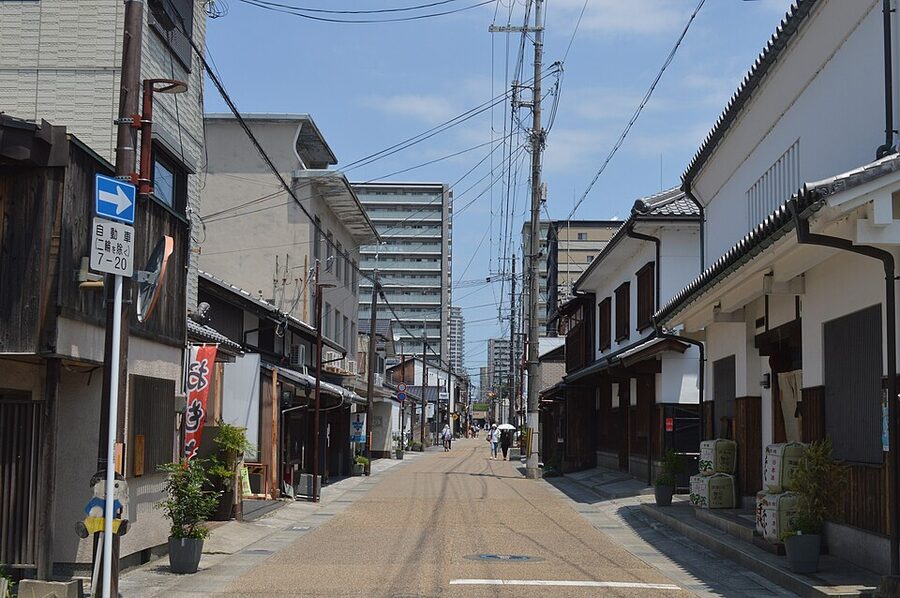
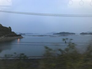
From Tsuchiyama through Minakuchi, Ishibe, Kusatsu, and Ōtsu, the road runs along the south end of Lake Biwa. Kusatsu has the best-preserved post-station street on the entire route. A 400-metre run of wooden merchant buildings, including an honjin (the official inn for travelling daimyo) that’s now a small museum. Stop. The lake itself is a coda: by the time you ride along its southern shore the trip is essentially over, and the green-hilled view across the water to the western side is restful in a way the rest of the route isn’t.
If your legs hold and you have an extra day, this is also where the route intersects with a much nicer parallel ride: the Biwaichi loop around Lake Biwa. Cyclists doing the full Tōkaidō plus a Biwaichi rest day finish in Kyoto with calmer legs and better pictures than they would on a straight push.
The last 10 km into Kyoto
From Ōtsu the old road climbs gently over the Ōsaka-no-seki barrier. (Don’t confuse with the city of Osaka: this is a different “Osaka”, written 逢坂, meaning “meeting hill”.) It drops past Yamashina and enters Kyoto on the eastern side. The historic terminus is Sanjō Ōhashi, the bridge over the Kamogawa river. There’s a small bronze statue of Yaji and Kita, the comic travellers from Jippensha Ikku’s 1802 picaresque Tōkaidōchū Hizakurige, on the eastern abutment. Touch it for luck. Take a photo.
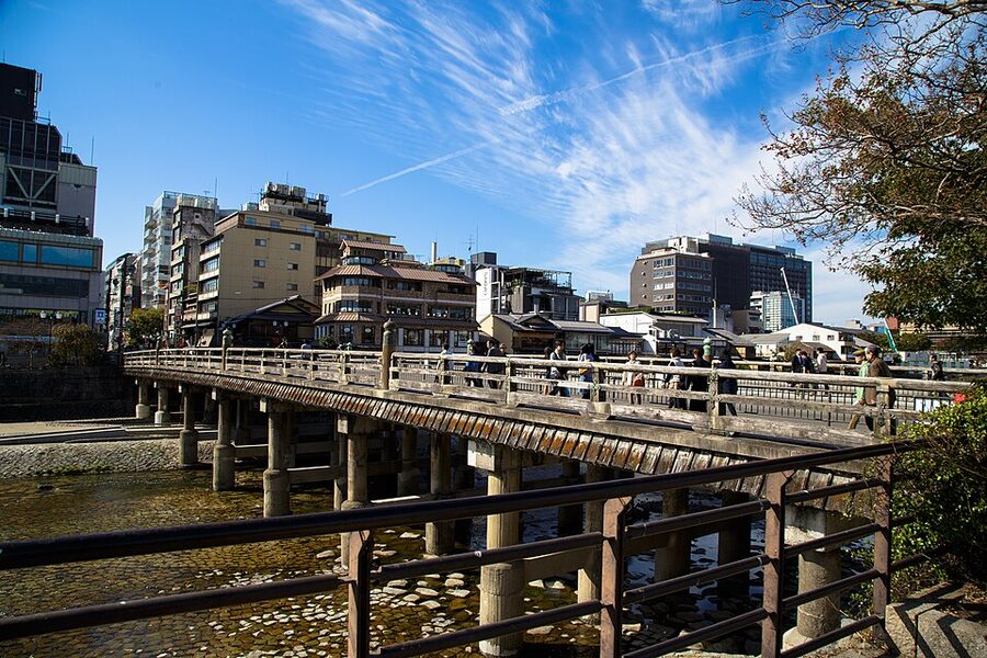
The actual end of the ride is rather anti-climactic. The Sanjō bridge is a major intersection. Life-as-usual goes on around it: tourists walking past, cars going every which way, nobody paying any attention. After 500-plus kilometres of riding, you arrive in central Kyoto and the world’s response is: “and?” Take it as a compliment. The Tōkaidō has been ending here since 1601. You’re just the latest.
Six days, seven days, ten days: planning the daily distances
The pace question is mostly settled by what kind of trip you want and how much you climb. Here’s what the data says.
The relaxed-touring pace: 7 days, 495.5 km, ~71 km/day. Build weather delays into your plan. Target around 80 km/day. Treat the ride as moving sightseeing — stops at every post-station marker, photographs, occasional lunch in the post town. This is the slowest reasonable pace.
The fast pace: 4 days, around 130 km/day. That’s serious. Skips most stops. For the average tourist cyclist this is too aggressive — you’ll see nothing.
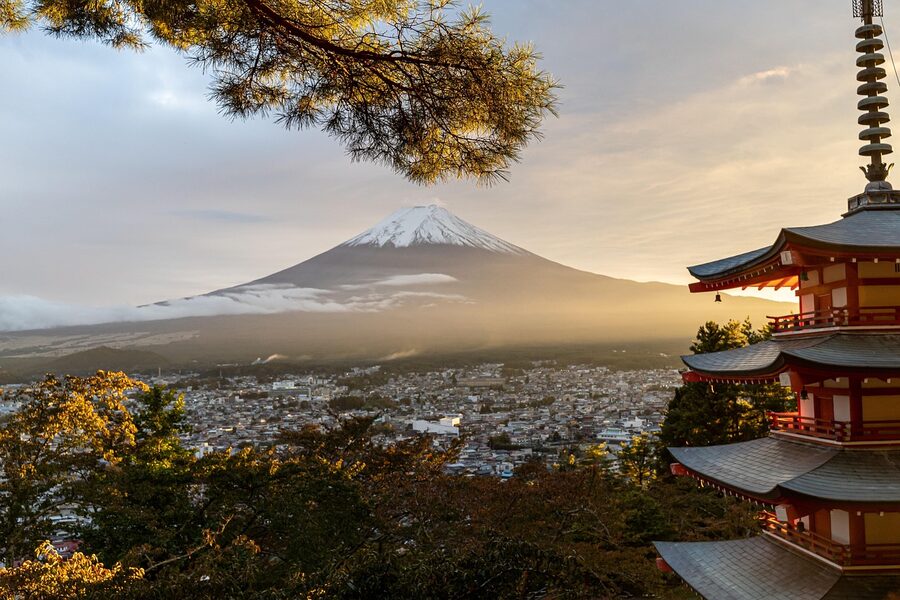
The Bikepacking.com video team (Lea and Luca) split it into nine days at around 60–80 km/day, prioritising sightseeing over distance. Their longest day was the 70 km from Tokyo up to Lake Yamanaka at 1,473 m elevation. Technically a Mt Fuji loop variant rather than the strict Tōkaidō, but it slots well as a Day 1.
For most riders coming from overseas with reasonable but not exceptional fitness, 6–7 days at 80–90 km/day with one rest day is the sweet spot. That gives you time for Hakone, the Yui-Satta detour, Akasaka pine avenue, Suzuka, and Kusatsu (the things actually worth stopping for) without grinding the trip into pure transit.
Suggested 7-day breakdown
- Day 1: Nihonbashi to Odawara, 85 km, 200 m climbing. Set off 05:30. Be past Yokohama by 08:00. Easy afternoon along the coast through Ōiso and Hiratsuka. Sleep in a Toyoko Inn near Odawara Station.
- Day 2: Odawara to Mishima via Hakone, 35 km, 850 m climbing. Short day. Climb Hakone in the morning, descend to Mishima for lunch, optional ryokan night in Hakone-Yumoto if budget allows.
- Day 3: Mishima to Shizuoka, 80 km, 300 m climbing. The Yui-Satta detour is the day’s highlight. Stop for tea at Yui.
- Day 4: Shizuoka to Kakegawa, 75 km, 200 m climbing. Cross the Ōigawa, optional Hōrai-bashi wooden bridge crossing.
- Day 5: Kakegawa to Toyohashi, 80 km, 250 m climbing. Akasaka and Goyu pine avenues. Sleep in Toyohashi.
- Day 6: Toyohashi to Kameyama, 105 km, 200 m climbing. The hard day. Push through Nagoya early, cross the Ise Bay bridges, sleep west of Yokkaichi.
- Day 7: Kameyama to Kyoto via Suzuka, 95 km, 500 m climbing. Suzuka in the morning, lunch in Tsuchiyama, finish at Sanjō Ōhashi by 17:00.
Total: ~555 km, ~2,500 m climbing, six nights of accommodation. Three of those nights you’ll get good ryokan options; the other three are Toyoko Inn or APA Hotel territory. Budget ¥7,000–12,000 per night for lodging, a bit more if you splurge for one onsen ryokan.
Bikes, gear, and the question of riding your own
You have three options. Each has a real cost.
Ship your own bike. About ¥30,000–40,000 round trip from a US east-coast city via BikeFlights or similar, plus insurance. Pack it carefully. The advantage is enormous: you’re riding the bike you trained on. The disadvantage is the four-hour assembly the first morning at your hotel and the four-hour disassembly at the end, plus the chance the airline staff drops it.
Rent in Tokyo. Tokyo Cycling Tour & Rental near Akihabara stocks Trek, Specialized, and Cannondale road bikes. Five-day rental runs around ¥13,000 plus a refundable deposit. They include a rinko bike-bag for the bullet train back from Kyoto, which is essential. Bicycle Rental Tokyo is the other major shop. Both speak English. Both have pedal-and-saddle adjustment included; bring your own clipless pedals if you use them.
Book a guided tour. RAID Cycling, Tokyo Cycling Club, ebiketourjapan.jp all run multi-day Tōkaidō or Tōkaidō-adjacent tours that include a quality road bike. Costs scale accordingly: expect roughly ¥750,000 to ¥1,200,000 for a guided 8-day trip with bike included.
One thing to factor in: at 80 kilometres per day with two pannier bags or a small frame pack, you don’t need a touring bike. A standard endurance road bike with 28 mm tyres is plenty. The road surface on the Tōkaidō spine is excellent. You’ll need wider tyres only if you do a lot of the genuine old footpath sections, which most cyclists skip because they’re better walked.
What to eat (and where the ¥500 lunches are)
Food is the cheap part of this trip if you let it be. A 7-Eleven onigiri costs ¥150. A bowl of soba in a small restaurant costs ¥700–850. A katsu set lunch at a chain like Yoshinoya or Sukiya is ¥700–900. You can eat well for ¥2,500 a day if that’s your priority.
Three named places worth a stop:
- Daikoku-ya, Kakegawa. Standing-room kakesoba at ¥480, near the JR station, 06:30 open for early-departing cyclists. Practical, not romantic.
- Akasaka Ōhashiya, Akasaka-juku. The working hatago mentioned earlier. Lunch teishoku ¥1,800 with local vegetables and grilled fish. They serve cyclists who arrive in lycra without comment.
- Tsuchiyama Tea Centre. On the descent from Suzuka. Cold barley tea is free for travellers, hot matcha is ¥500 with a small Japanese sweet. The proprietor is in his 70s and will quiz you on where you’ve ridden.
Vending machines deserve a paragraph of their own. Japan has roughly one vending machine per 23 people; on the Tōkaidō you’re never more than 500 m from one. They sell hot canned coffee, cold tea, sports drinks, occasionally hot soup. They take the IC card on your phone. Mid-summer rides depend on them.
When to ride: the season call
The Tōkaidō has two short windows where everything works.
Late March to early May. Cherry blossom in late March-early April through the Tokyo–Hakone–Shizuoka section. The Akasaka pine avenues are at their best. Daytime temperatures 12–22 °C. Days lengthen daily. The drawback: Golden Week (29 April to 5 May) jams every business hotel along Route 1 with domestic tourists. Book in advance or ride before/after.
Late September to early November. Autumn leaves come late at this latitude: mid to late November in Hakone, early November in Shiga. Daytime 12–22 °C again. The October rainy spells are short and pass quickly. This is probably the better window if you only get one trip.
Avoid: late June through mid-September. The tsuyu rainy season ends around 18 July, but the heat that follows is brutal. Daytime 33–38 °C and humidity that locks you to the kit. Most Japanese cyclists who ride the Tōkaidō schedule for cooler weather. December to February is rideable but you’ll hit ice and snow at Hakone Pass and Suzuka Pass; the Pacific coast in between is mild but exposed to north-westerly winds.
The negatives, and who shouldn’t do this ride
This isn’t the Shimanami Kaido. It’s not even close. The Shimanami Kaido is a purpose-built cycling route across six islands, with rental shops every 10 km, dedicated lanes, polite drivers, and 70 km of mostly-traffic-free riding. The Tōkaidō is a national highway with traffic lights, trucks, bypass detours, and stretches that genuinely aren’t fun.
Specifically:
- The Tokyo–Yokohama corridor is industrial and ugly. You ride it because you have to, not because you want to.
- The Hamamatsu–Nagoya middle is the worst middle of any major Japanese ride. Plan it as transit.
- The bypass-detour navigation requires real attention. One missed turn around Numazu or Yui costs you hours.
- The historic post stations are mostly markers, not preserved architecture. If you’re coming for “Hiroshige’s Japan”, the Nakasendō inland route via Tsumago, Magome, and Narai-juku is dramatically better preserved, but it’s a different ride with much more climbing.
If your priority is preserved Edo-era atmosphere, ride the Nakasendō instead. If your priority is car-free cycling, ride Shimanami or Awaichi on Awaji Island. If your priority is panoramic landscapes with little-to-no traffic, the Furano-Biei panorama road in Hokkaido is in a different league.
Then why the Tōkaidō? Because it’s the original. Because there’s a particular satisfaction in riding the road that connected the country for 400 years, complete with its modern compromises: Hakone tunnels, vending machines, the tiny pocket of preserved pine avenue at Goyu, the Sanjō Ōhashi bridge that hasn’t moved in twenty generations. You’re riding through history that’s still functional, not embalmed for tourism. That’s worth a few traffic lights.
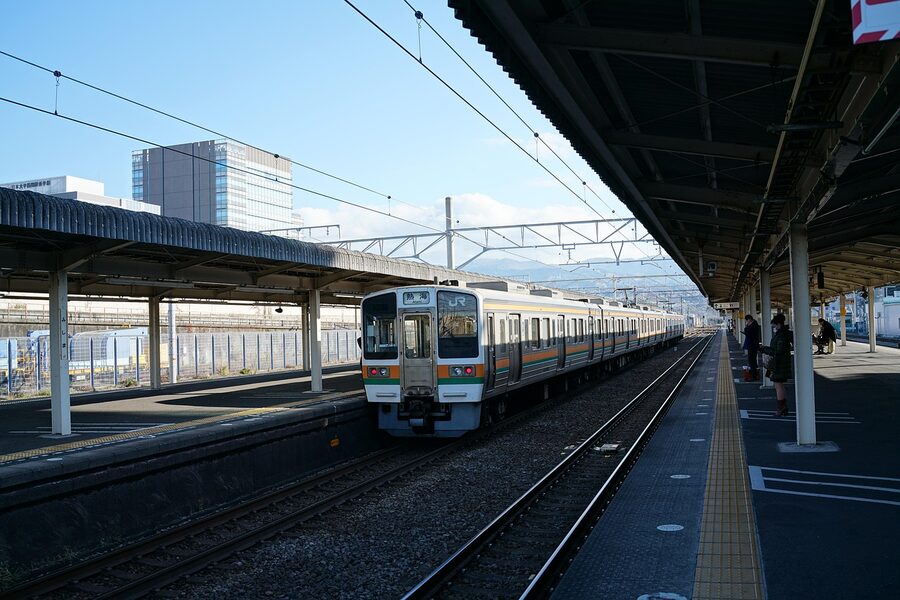
Train + bike: the bailout option
Critical to know: every section of this route has a parallel JR Tōkaidō Line. If your legs blow at Hamamatsu or your knee gives at Numazu, you can put the bike in a rinko bag and take the next train.
JR rules: the bike must be fully bagged, no protruding handlebars or wheels, and small enough to fit between your seat and the back of the next one. A 6.3 kg rinko bag like the Ostrich L-100 holds a full road bike with both wheels removed. Bag, no extra ticket. No bag, you can’t board.
The local trains stop at every post-station town. The Tōkaidō Shinkansen bullet trains run Tokyo to Kyoto in 2h 15m for ¥13,320, which is the fastest emergency exit you can possibly buy. The Shinkansen will take a bagged bike too, but reserve a window-end seat with the rear luggage space (the seat behind the last row of each carriage; reservation flag is “tokudai sōchimotsu”, “oversized luggage”).
For the full rules, the multi-day pass options, and which IC card actually works, check the cycling Japan FAQ. It covers train+bike etiquette, what’s allowed during peak hours, and the regional pass options.
Maps, books, navigation
You’ll need a GPS or a phone with offline maps. The free option that works: download Google Maps for the relevant prefectures (Tokyo, Kanagawa, Shizuoka, Aichi, Mie, Shiga, Kyoto), set bicycle mode, follow the blue line. Google’s Japanese cycling routing isn’t perfect (it occasionally tries to send you onto expressways) but it’s serviceable for 80% of the route.
Better option: Komoot or Ride With GPS premium with the JA OpenStreetMap data, which has cycling routes properly tagged. About ¥500/month, worth it.
For paper, two books are useful:
- Decision Edition: Tōkaidō 53 Stations Guide (Kodansha, ¥743). Japanese-language but the maps are usable without reading the text.
- The Old Tokaido by Patrick Carey. English-language walking guide with cyclist-applicable detail on the post stations. Around ¥3,200.
Beyond Google’s blue line, the best free resource for the bypass detours is a Japanese-language guide online (Google Translate handles it). Its three-page detour map is the only thing I’ve found in any language that solves the Numazu, Yui, and Shizuoka bypass problem properly.
Where to sleep: practical accommodation by stop
Business hotel chains line every major station along Route 1. The big four for cyclists are:
- Toyoko Inn. Basic, cheap (¥6,000–8,500 single), bike usually allowed inside the room. Locations at Odawara, Numazu, Shizuoka, Hamamatsu, Toyohashi, Yokkaichi, Kusatsu.
- APA Hotel. Slightly more expensive but generally larger rooms. Bike storage policy varies by branch; ask first.
- Comfort Hotel. Mid-range, free breakfast included, rooms around ¥8,000–10,000.
- Super Hotel. Budget tier with included onsen-style bath. Best value at the cheap end.
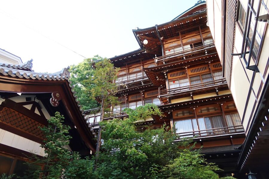
If you want one onsen-ryokan night, Hakone-Yumoto is the natural pick. Hakoneyumoto Onsen Hotel Honjin charges ¥15,000–25,000 per person per night with kaiseki dinner and breakfast included. The bike goes in the entrance lobby. Book a week ahead for weekends, two weeks ahead for cherry-blossom or autumn-foliage season.
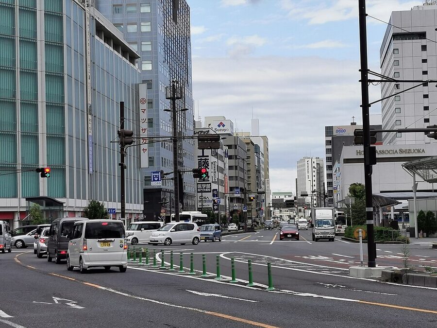
For Shizuoka mid-route, Hotel Associa Shizuoka (Booking | Agoda) is the easy pick. Right above the JR station, secure bike storage in the loading dock, ¥9,000–12,000 single. For Kyoto arrival night, the area around the Kyoto Imperial Palace is bike-friendly and walking distance from Sanjō Ōhashi; Hotel Granvia Kyoto at the station is the easiest if you’re shipping the bike home and want to crash within rolling distance of the Shinkansen.
Differentiating notes from other long-distance Japan routes
Quick comparisons against the other rides on this site:
- vs Shimanami Kaido (the gold standard for cycling). Shimanami is dramatically better as a riding experience, with dedicated cycling lanes across six islands, almost no car traffic, perfectly preserved fishing villages. It’s also 70 km, not 535. The Tōkaidō wins for those who specifically want a transit between Tokyo and Kyoto, with all the historic weight that carries.
- vs Lake Biwa loop (Biwaichi). Biwaichi is 200 km of mostly-flat lakeside cycling, can be done in two days, has dedicated cycling infrastructure for most of the route. If you want long-distance Japan riding without the urban-corridor headaches, do Biwaichi instead. Better still, do the Tōkaidō and add a Biwaichi rest day in the middle.
- vs Tobishima Kaido. The Tobishima Kaido is the under-the-radar sister route to Shimanami: same Setouchi inland-sea geography, none of the crowds. Different category to the Tōkaidō entirely; pair them as a longer Japan cycling holiday rather than seeing them as alternatives.
- vs Awaji Island loop. Awaichi is 150 km of coast-hugging riding off the south end of Honshu. A one or two-day loop with serious climbs and serious sea views. Worth doing if you have an extra weekend at the end of the Tōkaidō.
- vs Furano-Biei panorama road. The Furano-Biei panorama route in central Hokkaido is the visual antithesis of the Tōkaidō: rolling lavender fields, almost no traffic, big sky. Different country, basically. Schedule both into a longer trip.
The Yaji-Kita question
Jippensha Ikku’s 1802 picaresque novel Tōkaidōchū Hizakurige (“Shanks’s Mare on the Tōkaidō”) follows two travellers from Edo to Kyoto via the highway, getting drunk, falling for con artists, mistranslating local dialects, paying too much at every inn. It’s the founding road-trip story of Japanese popular literature, and any Japanese cyclist who rides this route knows it. The bronze statue at Sanjō Ōhashi is the standard finish-line photograph.
You don’t need to read it. But buying a bilingual edition before you go (Thomas Satchell’s English translation is in print, around ¥2,100) gives you 200 pages of period detail about exactly the road you’re riding, and what each post station was famous for in 1802. Some of those things are still true. The eel restaurants in Hamamatsu, for instance, have been there continuously for two and a half centuries. Knowing that turns a transit lunch into a small connection.
One last thing: the bullet train ride home
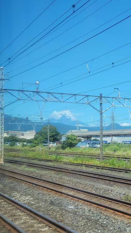
You finish at Sanjō Ōhashi. You pack the bike. You walk it to Kyoto Station. You take the Shinkansen back to Tokyo. The journey takes 2h 15m and the train follows the same route you spent six days riding.
For 2h 15m you watch through the window what you’ve just ridden, in reverse, at 270 km/h. The villages where you stopped for tea. The Hakone climb you sweated up. The Yui-Satta lookout. The Ōigawa river. Toyohashi, Hamamatsu, Shizuoka, Mishima, Odawara, Yokohama, Tokyo. It’s the closing chapter that the ride doesn’t have at Sanjō Ōhashi itself, and it works whether you’re a self-supported cyclist with a Toyoko Inn budget or a guided-tour rider on a million-yen package. The hikyaku couriers in 1700 took three days. You took six. The Shinkansen takes 135 minutes. Sit by the window. Buy a beer from the trolley.
That spread, that gap between three days and 135 minutes, between ¥66,500 and ¥1,020,000, between the historic road and the modern train running parallel to it, is the entire trip in compressed form. You arrived at one end of it. You’re leaving from the other.
_02.jpg)
.jpg)
.jpg)
.jpg)
_01.jpg)