“Doing 150 kilometres of Awaichi in a day is brutal for first-timers.” That’s the warning Cyclism Awaji’s rental staff put at the top of their own beginner’s guide, and it’s rare to see a Japanese rental shop talk down its own route. They reckon even a fit rider needs ten hours. They tell people to leave at 7:30 in the morning and stop sightseeing. They suggest splitting it over two days so you can still walk afterwards.
I’d take their word for it.
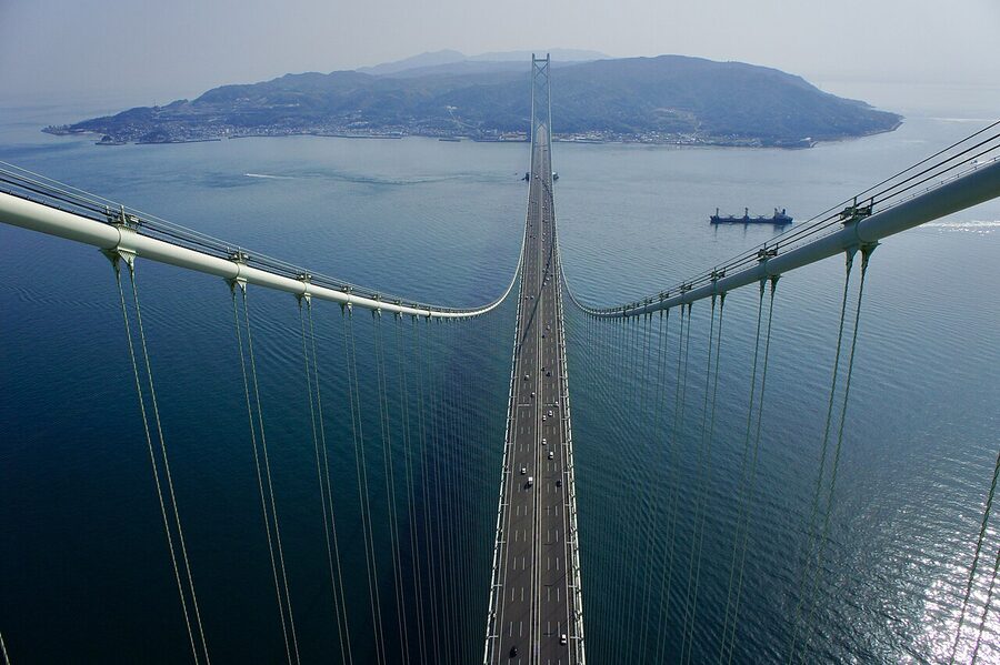
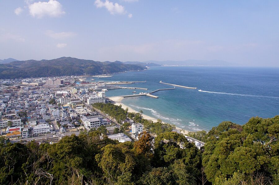
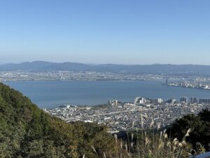
Awaichi (淡路島一周, “Awaji once around”) is a 150-kilometre coastal loop of Awaji Island in Hyogo: the largest island in the Seto Inland Sea. Hyogo Prefecture officially calls it a “Cyclists’ Sanctuary.” The Japanese cycling press treats it as a peer of Biwaichi and the Shimanami Kaido. It’s one of the country’s three flagship signed long-distance routes. About 1,200 metres of climbing, two genuinely steep descents, a handful of hills you can taxi over if your legs go, and almost everything else right next to the water.
It’s also one of the most accessible big rides in Japan. You can sleep in Kobe, take the 7:20 ferry to Iwaya, and be on the bike before 8:30. Most cyclists I’ve talked to either love it or feel ambivalent. Almost no one calls it dull.
In This Article
- Awaichi at a glance
- Why this loop earns its hype
- How Awaichi compares to Biwaichi and Shimanami
- Getting to the start
- Akashi to Iwaya by ferry (the best option)
- The bus option (Honshu side)
- From Shikoku side
- Renting a bike on Awaji
- Cyclism Awaji
- Circolo / Awaji Bicycle (道の駅東浦)
- The route, clockwise from Iwaya
- Iwaya to Sumoto, ~40 km, the warm-up east coast
- Sumoto to Fukura, ~35 km, the punishing bit
- Fukura, the southern tip, Onaruto Bridge and whirlpools
- Fukura to Goshiki, ~30 km, the headwind west coast
- Goshiki to Iwaya, ~45 km, the home straight
- One day, two days, or three
- One day (the time-trial)
- Two days (the sweet spot)
- Three days (the touring version)
- Where to stay
- Iwaya / Yumebutai (north, the start and finish)
- Sumoto (mid-island, lunch town and one-night base)
- Fukura / Minami-Awaji (south, two-day overnight)
- Food on the route
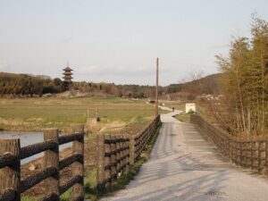
- Things worth getting off the bike for
- Izanagi-jingu
- Awaji Hanasajiki
- The 100 Step Garden
- Sumoto Castle ruins
- What to skip
- Practical: navigation, signage, mobile data
- Weather windows and seasonal traps
- What can go wrong
- Renting an e-bike vs. road bike
- Is Awaichi worth it?
Awaichi at a glance
| Detail | Number | What it means on the road |
|---|---|---|
| Distance | 150 km (Hyogo signs say 150.4) | Most-quoted figure. The full clockwise circuit if you stick to the coast. |
| Elevation gain | ~1,200 m | Mostly in two steep south-coast sections. |
| Direction | Clockwise (right-hand side) | Puts you in the lane closest to the sea. The local norm. |
| Recommended time | 10 hours one-day, 2–3 days touring | Cyclism Awaji say 7:30–8:30 start for one-day, 70–80 km/day for two-day. |
| Hardest stretch | Yura to Fukura, ~25 km | Continuous up-down with one ~140 m climb in 4 km out of Yura. |
| Surface signs | 127 painted Awaichi route markers (R7) | Hyogo’s own programme, 20 cm wide, 130 cm tall, every junction. |
| Best season | March–June, October–November | Mid-summer is uncomfortably hot on the open east coast. |
Why this loop earns its hype
I’d put four things at the top.
First, it works as a complete circuit. You ride away from one bridge and come back under the same one. There’s no faff with shuttles, return trains, or rinko bag negotiations, the route ends where it starts.
Second, the road quality is genuinely better than people expect. Hyogo Prefecture has poured money into Awaichi specifically because cycling tourism is part of the local rebuild after the 1995 quake. The 127 painted route markers (62 of them added in the 2025 fiscal year alone) mean you can put the map away on the easy stretches.
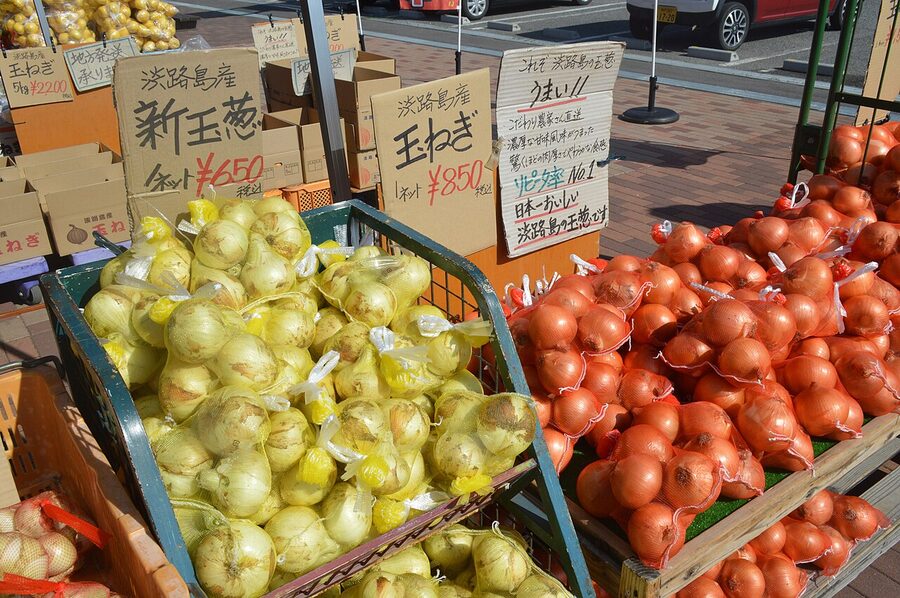
Third, the food. Awaji is the onion-growing capital of Japan, and unlike most cycling routes where you eat to survive, here you eat for the ride. Onion soup at a roadside cafe. Onion tempura. Onion senbei in your back pocket. The island is also where Kobe beef actually comes from, despite the name.
Fourth, you can scale the difficulty. Want a flat 18 km loop near the bridge? It exists. Want the 100 km “Awaichi Short,” which cuts off the worst climb? Hyogo signs that too. Want the full 150 km in one day? You can do that without ever wandering off marked roads.
How Awaichi compares to Biwaichi and Shimanami
If you’re choosing between the country’s headline loops, the rough sort is:
- Shimanami Kaido, 70 km, mostly flat, six bridges, the easiest of the three. The clearest “I rode in Japan” photograph you’ll get.
- Biwaichi, 200 km, lake instead of sea, near-flat. Bigger commitment than Awaichi on paper but actually less climbing.
- Awaichi, 150 km, sea views all the way, ~1,200 m of climbing, more variety than either of the others.
I’d ride Shimanami first if you’re new to Japanese routes, Awaichi second when you want a proper day’s ride, and Biwaichi when you want flat distance.
Getting to the start
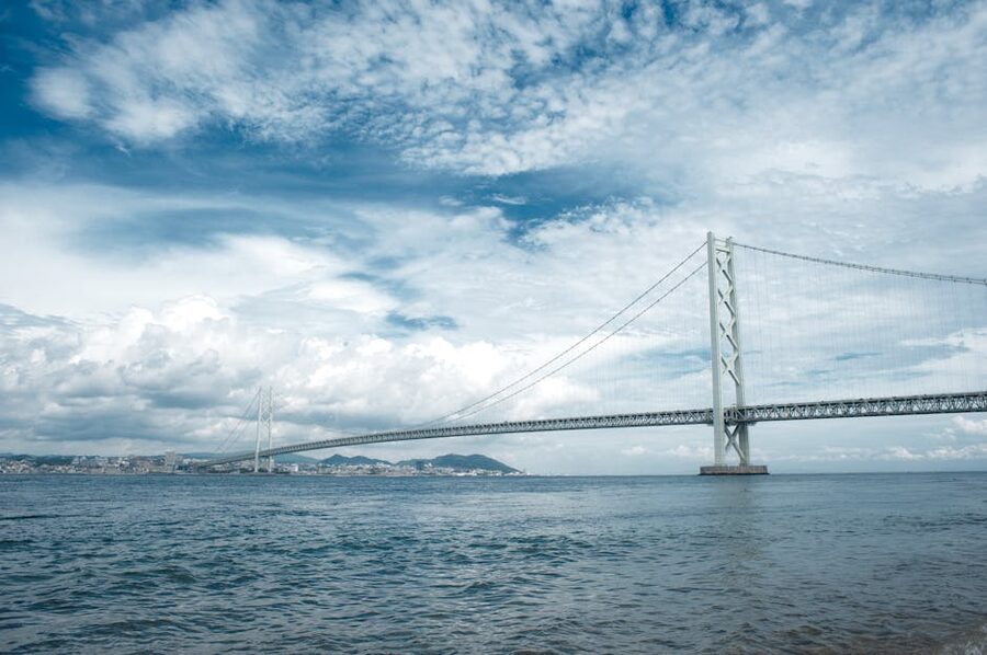
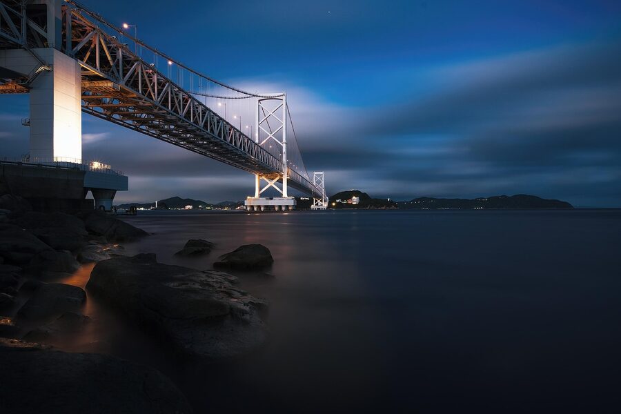
Iwaya is the standard starting point and has been since the route was first signposted. The most efficient way in is the Awaji Jet Line (tako ferry) from Akashi.
Akashi to Iwaya by ferry (the best option)
The Awaji Jet Line runs roughly twenty crossings a day between Akashi port (just south of Akashi station on the JR Sanyo and Kobe lines) and Iwaya port. The crossing takes 13 minutes. Bikes go on board for an extra fee on top of the ¥880 passenger fare; bring a rinko bag or be ready to pay the bicycle surcharge. Bring exact-ish change, staff are quick but the queue at peak weekend mornings is real.
From central Osaka or Kyoto, factor 90 minutes train to Akashi station, ten minutes’ ride to the port, then the ferry. From Sannomiya in Kobe, allow forty minutes total.
The bus option (Honshu side)
Buses cross the Akashi Kaikyo Bridge from Sannomiya and Maiko bus stops to multiple Awaji destinations. They take bikes only in a rinko bag, packed away with the wheel removed. Not ideal if you’ve got a road bike with internal cabling and don’t want to disassemble it on a sidewalk. Use the ferry.
From Shikoku side
You cannot ride a bike across the Naruto Bridge (the southern crossing). The only options are the highway bus from Tokushima, which takes three bikes per departure in a rinko bag for ¥660 plus the regular passenger fare, or the small ferry from Wakayama on the eastern side, ~¥1,800 with a bike, four daily crossings. Both options need a reservation.
Worth noting: Honshu–Shikoku Bridge Authority has been planning a bike path along the Naruto Bridge since the discontinued Shikoku Shinkansen project freed up the lower deck. Local advocates target 2027 for opening. Until then, plan to start from the Honshu side.
Renting a bike on Awaji
Two operators dominate the rental business at Iwaya, and both are genuinely competent. Skip the budget rentals you’ll find advertised at hotels, those are sit-up-and-beg bikes for short coastal pootles, not 150 km road machines.
Cyclism Awaji
The largest rental shop on the island, inside the Aqua Ignis Awaji wellness complex at Yumebutai. They open 7:30 weekends in cycling season (8:00 weekdays), which matters if you’re aiming for that early-morning Awaichi push. Cross bikes, e-bikes (worth it for first-timers: the climbs out of Yura with battery support are a different ride), and Trek road bikes from carbon framesets up. Their staff publish a route briefing in three languages, run a roadside trouble-support service, and will deliver to Iwaya port if you book ahead.
If you do nothing else, screenshot their elevation map before you start. The two danger spots they flag (the descent off the first climb out of Yura, and the final descent into Fukura) are exactly where most accidents happen.
Circolo / Awaji Bicycle (道の駅東浦)
Smaller, run by Masahi Yamada, an Awaji local and semi-professional triathlete. He’ll make you an espresso before the ride, runs a “first-timer” lesson package with a flat-tyre tutorial built in, and has lockers and showers for after. There’s also a free burger waiting if you finish the full 157 km variant, locally nicknamed “ichi-go-nana”, back at his shop. The model line-up is Orbea Avant and Cinelli Experience aluminium, plus Giant TCR and Specialized Venge in carbon, all sized to fit.
Both shops will hold luggage for the day. Both will recommend ride direction and weather conditions; check the wind forecast before they start packing your bike up because the west coast headwind is real.
The route, clockwise from Iwaya
Always clockwise. Two reasons: you’re in the seaward lane the whole way, and the prevailing wind on the open west coast tends to be from the north, so it gets behind you on the back half. Counter-clockwise is for masochists.
Iwaya to Sumoto, ~40 km, the warm-up east coast
You leave Iwaya on National Route 28, which is the main eastern coast road. The first 5 km hugs the bridge and is mostly flat. A handful of small headlands give the road the rhythm of gentle climb / sharp descent every kilometre or so, but nothing punishing.
The east coast is where you’ll spot the working side of the island: small fishing harbours, oyster racks, abandoned holiday homes, the occasional cat. There are also onion fields starting around Higashiura. The 道の駅 at Higashiura Terminal Park is the obvious first food stop and sells onion-flavoured everything: soup, jam, pie, senbei crackers. Most of it is genuinely good. The cafe inside opens at 9:00.
Sumoto is the largest town on the island and the natural lunch stop on a one-day ride or the overnight on a two-day. The approach is via Ohama Beach, which is genuinely one of the best stretches of sand in western Japan, golden rather than the volcanic-grey you’d expect this far south of Tokyo. Park the bike at Sumoto Civic Square (the converted red-brick cotton mill), grab lunch at one of the kushikatsu joints in the Retro Sumoto Komichi area, and consider the foot bath next to the tanuki statue if you’ve got 15 minutes.

Sumoto to Fukura, ~35 km, the punishing bit
This is the section every Japanese ride report calls “アワイチ最大の山場” (the biggest test on the loop). Out of Yura, the road climbs roughly 140 metres in 4 km, then drops. Then climbs again. Then drops again. Cyclism Awaji’s elevation map describes “approximately 25 km of continuous up-down” through to Minami-Awaji.
The descents are where it gets real. Two specific bends (the first hilltop descent leaving Yura, and the final drop into Fukura) are flagged on every Japanese guide as accident hot spots. Tight angles, oncoming traffic, and deer on the road after dusk. The local advice: keep weight back, pump both brakes, take it embarrassingly slow if you’re tired. There’s no prize for fast descents on a circuit ride.
If your legs are gone, the bypass is real and signed: at Aman village, head north toward Yawata, then left at Yawata crossroads into Fukura. You skip the worst climb and lose maybe 5 km of distance.
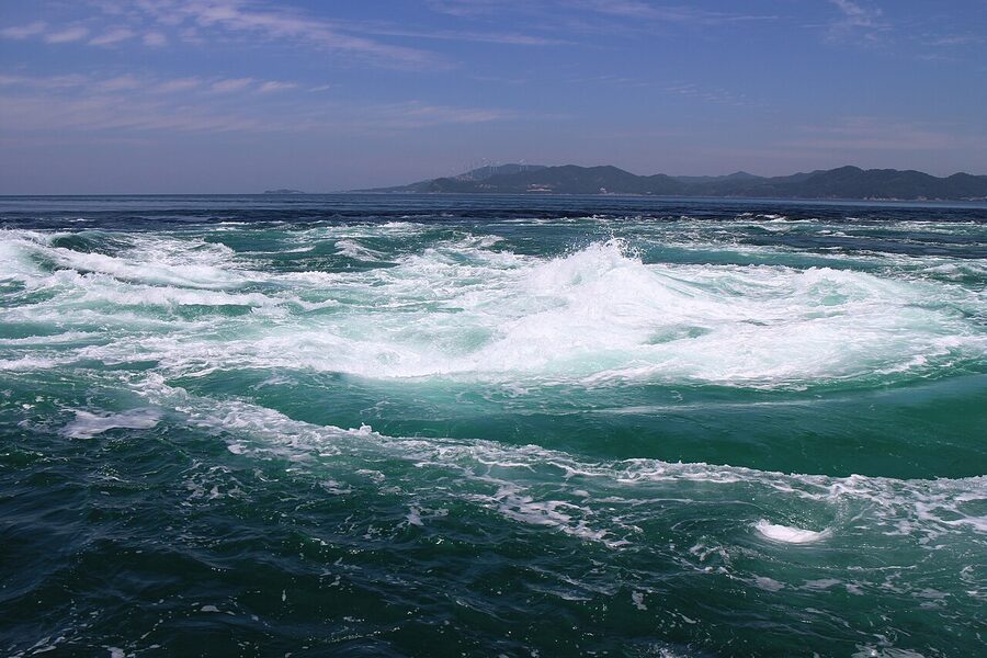
Fukura, the southern tip, Onaruto Bridge and whirlpools
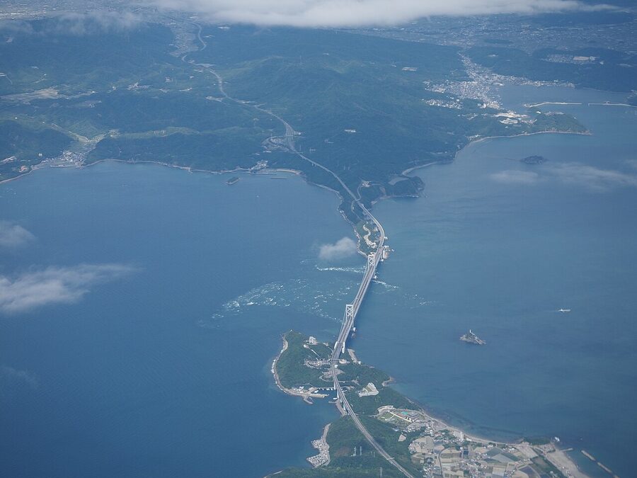
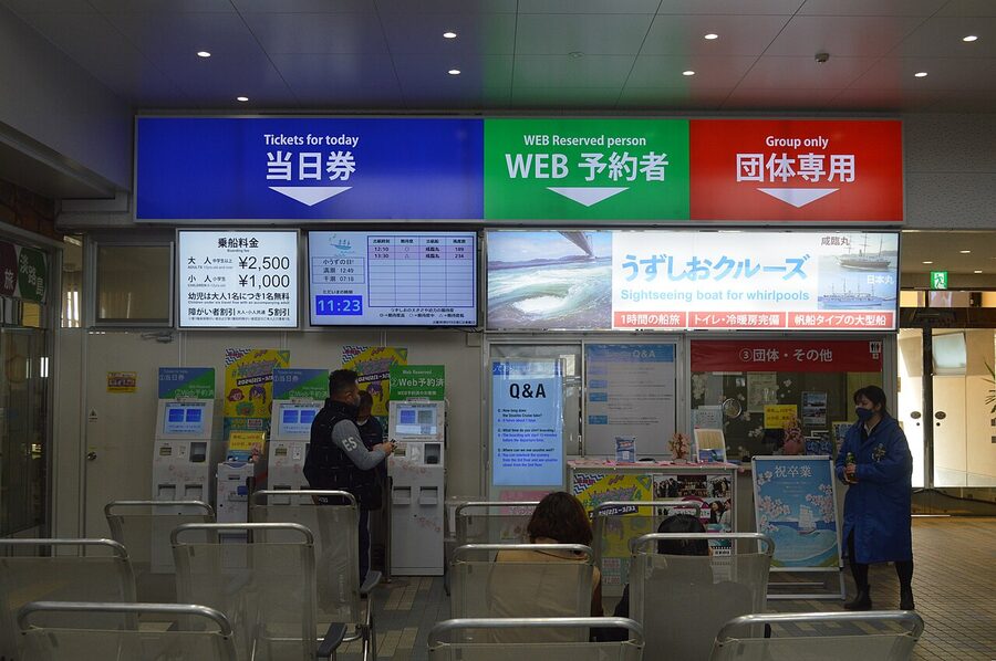
Fukura is where the Onaruto Bridge crosses to Shikoku, and the Naruto whirlpools spin in the strait below. They’re a tidal phenomenon, biggest at full and new moon spring tides, basically zero at neap tides, so check a tide table before banking on a viewing. The Uzu-no-Michi observation walkway extends 450 metres along the underside of the bridge and is the cheapest viewing option (¥510 adult). The boat trips from Fukura port get you closer but cost more (¥2,500 adult).
Michi-no-Eki Fukura is the obvious refuel stop. Octopus on rice (the strait is one of the country’s main octopus fisheries), Awaji beef bowls, ice cream, vending-machine coffee, and good toilets. Don’t sit too long, you’ve still got 75 km to go.
Fukura to Goshiki, ~30 km, the headwind west coast

The west coast is locally called the Sunset Line for obvious reasons, by mid-afternoon the sea on your left turns the colour of a tangerine. It’s also where the headwind shows up. Awaji sits in the wind tunnel between Honshu and Shikoku and on a north-wind day the back half of your ride from Fukura to Iwaya is a noticeable grind.
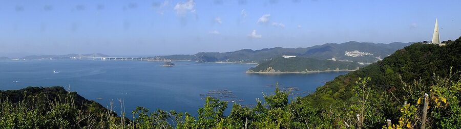
Keino Matsubara, around 18 km north of Fukura, is the obvious break. It’s one of Japan’s officially registered “Hundred Famous Pine Groves”, about 2.5 km of black pines lining the beach. There’s a road station on the inland side with proper toilets and a cafe; the seaward side has campsites and benches. If your legs need a real break, this is where I’d take it.
From Keino you continue through Goshiki and the small fishing town of Tsuna. The road quality is excellent here, wide painted shoulders, light traffic, and the route signs come every few hundred metres.
Goshiki to Iwaya, ~45 km, the home straight
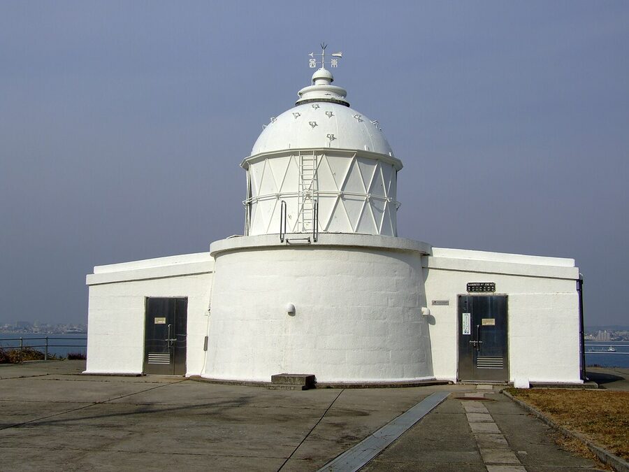
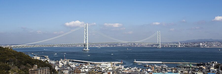
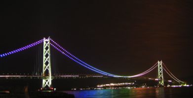
The final 45 km is the easiest stretch on the loop. Gently rolling, almost all coastal, painted route markers every 100 metres. By Esaki lighthouse on the northwest headland you’ll be able to see the Akashi Kaikyo Bridge again. The closing run-in to Iwaya passes Awaji Hanasajiki up on the hillside, the Yumebutai complex on your right, and a string of cafes and the Westin where you’ll be tempted to stop.

The traditional finish is the same Iwaya port pier you started from. The metal sculpture by the promenade, two stylised cyclists circling the island shape, is the photo every Awaichi finisher takes. Then a soak at Matsuho-no-Yu (the public bath overlooking the bridge, ¥1,000 adult, towels available) before the ferry back.
One day, two days, or three
How long Awaichi takes depends on what you’re there for.
One day (the time-trial)
Doable for a fit cyclist who starts at 7:30 from Iwaya, doesn’t sightsee, eats while moving, and has decent climbing legs. Plan for ten hours including stops. Cyclism Awaji’s guidance is brutally clear: this version is “very harsh for beginners.” If you’re new to road cycling or your longest training ride is under 80 km, don’t try it. You’ll either bonk on the south coast climbs or finish in the dark with deer on the descents.
Two days (the sweet spot)
This is what most local riders recommend and what I’d suggest. About 70–80 km per day. The natural overnight is Fukura or Minami-Awaji at the southern tip, Hotel & Resort Minamiawaji and the smaller ryokans around Fukura port both cater to cyclists. Day one Iwaya to Fukura via Sumoto (95 km, including the climbs); day two Fukura back to Iwaya via the west coast (75 km, mostly flat). You get time for an onsen, a proper meal, and the south-coast climbs feel manageable rather than a war of attrition.
Three days (the touring version)
Around 50 km a day with two overnights. You can actually visit Sumoto’s indigo-dye studios (Ai Aii Natural Indigo, run by Sally and Junichi Hancox in a converted house, runs 90-minute workshops by appointment), do a “Wa French” lunch at Yumegura, an 80-year-old farmhouse restaurant in the hills above Sumoto run by chef Takeshi Horii, and stop at Awabi Ware for the local pottery. It’s the way to ride it if you genuinely care about the cultural side.
Where to stay
Iwaya / Yumebutai (north, the start and finish)
The Westin Awaji Island Resort & Conference Center sits inside the Yumebutai complex, which means you stay inside a Tadao Ando building and ride out the door directly onto the cycling route. Spacious rooms, big-buffet breakfast (try the onion soup), bike storage on request. The most expensive option but the convenience for an early start is real.
Smaller and cheaper options cluster around Iwaya port itself, fine for a single overnight before or after the ride.
Sumoto (mid-island, lunch town and one-night base)
Sumoto Onsen has half a dozen old hot-spring hotels that have seen better days but are clean and bike-friendly. The covered shopping arcade in Retro Sumoto Komichi has a string of small ryokan-style stays plus modern guesthouses. If you want food and a hot bath in walking distance, this is the easiest base.

Fukura / Minami-Awaji (south, two-day overnight)
Smaller selection. Hotel & Resort Minamiawaji has the views and the onsen; the smaller ryokans around Fukura harbour are cheaper and better for a one-night cycling stop. Dinner here is dominated by the local catch. The Naruto Strait octopus is the must-try, and the fugu in season is taken seriously.
One thing to flag everywhere: when you book, tell the property you’re arriving by bike. Most are happy to store the bike indoors overnight, but the smaller places need warning. The standard request, 「自転車を屋内に置かせてもらえますか?」 (“could you let me keep my bike indoors?”), is what every Japanese guide recommends asking at booking.
Food on the route
Awaji has three or four food things worth eating that you’ll find hard to get elsewhere.
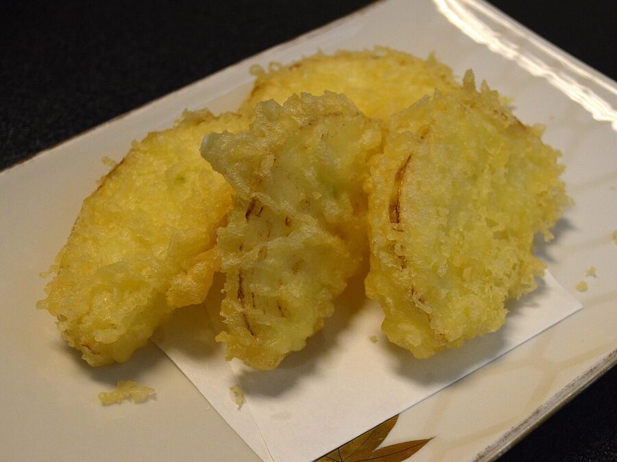
Onion-anything. Awaji’s “shintamanegi” early-harvest onions are sweet enough to eat raw. The local shrines do them as ice cream (sweeter than it sounds, ~¥400). Curry-rice with extra onion is the default road-stop lunch. Onion senbei (about ¥500 a bag) is the easiest souvenir.
Awaji beef. Yes, Kobe beef. Most of what is sold under the Kobe label is raised on Awaji and shipped north for finishing. A bowl at Michi-no-Eki Fukura runs ¥1,800–2,500. There are also high-end barbecue restaurants along the west coast aimed at the weekend Osaka crowd.
Octopus. The Naruto Strait between Awaji and Shikoku is a major octopus fishery. Tako rice (octopus on rice) at any port-side cafe in Fukura is ¥1,200–1,500.
Awaji oranges. Locally called Naruto orange, bittersweet like marmalade. In season Nov–Feb. The road-stop sodas made with the juice are the only sports drink you’ll need on the west coast.
Carry an emergency snack. The stretches between Sumoto and Fukura, and Fukura and Goshiki, can go 12–15 km without a convenience store. Cyclism Awaji’s guidance is to eat before you feel hungry, bonking (“hunger knock”, they actually use the English term) is a real risk on the south coast climbs.
Things worth getting off the bike for
Izanagi-jingu
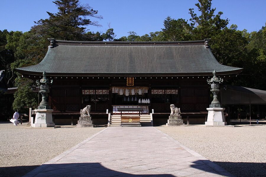
The mythological “first shrine” of Japan, founded by the god Izanagi himself per the Kojiki. It’s a couple of kilometres inland from the west coast at Tsuna, on flat road, and the detour adds about 4 km total. Free entry. The two 900-year-old camphor trees fused into one trunk behind the main hall, Meoto-no-Okusu, are the photo every Japanese pilgrim takes.
Awaji Hanasajiki
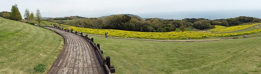
Free public flower fields on the hillside above the east coast about 8 km south of Iwaya. Different bloom each season, rape flowers in spring, salvia in summer, cosmos in autumn. The view back over the bridge is the second-best photograph on the loop after the Naruto whirlpools.
The 100 Step Garden
Tadao Ando’s Yumebutai complex is the architectural heavyweight of the loop. The Hyaku-dan En behind the Westin is a 100-square terraced garden built as a memorial to the 1995 Hanshin earthquake victims. It’s a steep walk from the bike racks at the conference centre but worth 20 minutes. Free to enter the public sections.
Sumoto Castle ruins
A short walk above Sumoto town, free, no entry charges, and the best vantage of Sumoto bay. The reconstruction of the keep is sparse but the ramparts and the panorama are the draw. Easy 15-minute detour off the bike.
What to skip
The Pasona Group’s “Nijigen no Mori” Naruto-and-Godzilla anime theme park, the multiple Hello Kitty smile-themed attractions on the west coast, and the cluster of pop-culture restaurants between Awaji City and Iwaya. They’re commercial regeneration efforts that the local prefecture supports because the post-earthquake west coast genuinely needs the tourism revenue. But they have nothing to do with why you’d ride this loop. If you want anime parks, go to Tokyo. If you want Awaichi, ride past them.
Practical: navigation, signage, mobile data
The Awaichi route is the most-signposted long-distance cycling route in Japan after Shimanami. As of 2025 there are 127 painted blue-and-white route markers (“Awaichi” plus a directional arrow) at every junction along the official course. Each is 20 cm wide and 130 cm tall, painted directly on the road surface.
If you can read the signs you don’t really need a GPS, but most riders run Komoot or Strava on a head unit anyway because the side roads to viewpoints aren’t always signed. Mobile data coverage is excellent across the entire island, Awaji is a Hyogo prefecture commuter belt, not a remote island, and prepaid SIMs work fine. Complete offline maps from openstreetmap-based apps are also good insurance.
For factual stuff that’s not strictly cycling, visa rules, train+bike etiquette, weather windows, what to do in a real road emergency, see the cycling Japan FAQ.
Weather windows and seasonal traps
The window split is real. The two genuinely good windows are March to early June and October to November. Both give you mild temperatures, manageable wind, and decent rain odds.
July and August are uncomfortably hot. The open east coast is in full sun for the first 40 km of the clockwise loop, and there’s no shade. Ride before 8:00 if you must, and consider a 5:30 dawn start.
Late summer is also typhoon season. Hyogo isn’t on the main typhoon track but the bridge ferries cancel for high winds; check the forecast 24 hours out. Winter is cycleable in theory but the wind tunnel between Honshu and Shikoku makes it brutal, the Westin Awaji’s exposed location actually closes its open-air spa in mid-winter.
The local rainy season (“tsuyu”) runs late May to mid-July. Mornings are usually fine; afternoons throw heavy thunderstorms. Roll a rain jacket no matter what the morning forecast says.
What can go wrong
Three things actually do go wrong on Awaichi, in roughly the order of likelihood:
Wind on the back half. The west coast headwind from Fukura north on a north-wind day is the single most common reason riders abandon. There’s no way around it, if the forecast shows north winds above 7 m/s, either bring an aero set-up or do the loop counter-clockwise (sacrificing the lane-side advantage but putting the wind at your back on the harder section). Most local riders just absorb the slow north section and ride accordingly.
Punctures. The southern climbs out of Yura have rough surface in places where the road has been repaired ad-hoc. Carry two spare tubes and CO2 cartridges. Cyclism Awaji’s guide insists on this because their “trouble support” callout, they will come to you with a van, is fee-paid; it costs about ¥5,000–8,000 to get rescued. Carry tubes.
The deer descents. Both Yura and Fukura descents have signs warning of deer at dawn and dusk. The first big climb out of Yura also gets deer in the late afternoon. If you’re behind schedule and finishing in the half-light, slow down on every descent below the saddle.
Renting an e-bike vs. road bike
I’d take an e-bike. The 1,200 m of climbing on Awaichi isn’t the same shape as a Tour de France stage, it’s broken across two short, steep clusters with rough surface in places, and an e-bike turns those from “wars of attrition” into “active recovery between flat sections.” You also get to enjoy the sea views instead of staring at your stem.
The case against: e-bike rental from Cyclism Awaji is roughly ¥7,500–9,000/day vs. ~¥5,000 for a quality road bike. And on a one-day Awaichi attempt, the battery range becomes a real planning issue. Bring a backup pack or pace the assist on flat stretches. If you’re a serious roadie used to 4-hour rides at threshold, take the road bike. For everyone else, the e-bike is the better call. Cyclism specifically recommend “battery with extra capacity” for the full loop in their guidance.
Is Awaichi worth it?
For most cyclists who travel to Japan, yes, but not as their first or only ride. Shimanami Kaido is a better introduction (gentler, shorter, more visually iconic). Awaichi is the next-step ride: longer, harder, more varied, and meaningfully more rewarding.
If you’re choosing between the country’s three signed loops, the rough call is: Shimanami for first-timers, Biwaichi for flat-distance fans, Awaichi for variety. Or pick one of the alternatives: the Tobishima Kaido if you’ve already done Shimanami and want the quiet sister route, the Tokaido coastal cycle if you want a multi-day point-to-point, the Furano-Biei panorama route if you want big-sky countryside instead of coast.
What I wouldn’t do is rent a sit-up bike at a beach hotel and try the eastern coast for 30 km. That’s not Awaichi, that’s a beach ride. The whole point of the loop is the south-coast climbs and the west-coast wind. Without those, you’ve just done a flat warm-up. Either commit or pick a different ride.
Do it once and you’ll understand why the prefecture calls it a Cyclists’ Sanctuary. The Iwaya finish-line photograph (the metal sculpture of two riders circling the island) turns into the kind of memory you’ll bore people with. That’s a fair return on ten hours of pedalling.
.jpg)
.jpg)