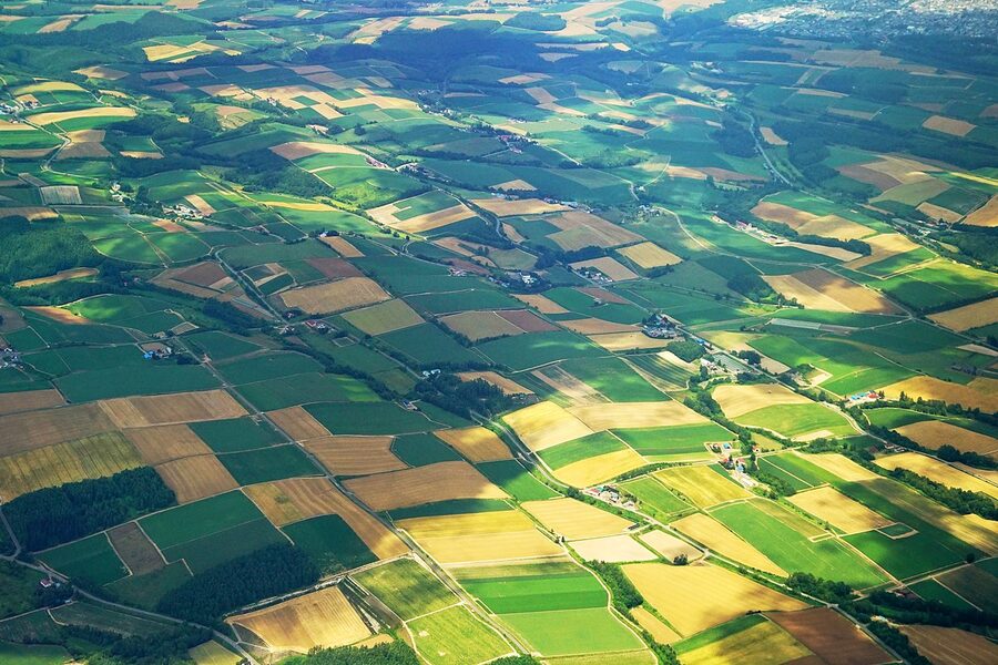
The official Furano-Biei cycling network is 256 kilometres long. It runs through six towns, every kilometre is numbered in paint on the asphalt, and almost no foreign cyclist has heard of it. Most people who ride here do the flat 60-kilometre Biei-to-Furano lavender hop, then go home and tell their friends they’ve cycled Furano-Biei. They’ve cycled about a quarter of it.
I’ll explain the full network in a moment. First the surprise itself: Route A is 88 km from Furano up to Biei via the lavender belt, Route B is a 150-km southern loop through Minamifurano and Shimukappu, and Route C is an 18-km lap of Lake Kanayama. Add them up and you get 256 km of signed, painted, marker-numbered cycling road across Biei, Kamifurano, Nakafurano, Furano, Minamifurano and Shimukappu. The Furano-Biei Area Tourism Promotion Council put the whole thing together and signed every kilometre. You can find the painted markers on the road surface, sequential numbers that match the official map. If you keep your map open you can’t get lost.
This guide is for the person who’s about to fly into Asahikawa or Sapporo with a folding bike, or who’s planning to rent. I’ll cover the classic flat day, the climb that nobody writes about, the southern lake route, the rentals you actually want, and the things the tourist office won’t tell you (like why Biei locals get visibly tense when cyclists wander onto farm tracks).
In This Article
- What the route actually is
- The three main routes at a glance
- Sub-routes within Route A
- The classic Biei to Furano flat day
- Shikisai-no-Oka and the Christmas Tree
- Farm Tomita: go at 06:00 or skip it
- Roller Coaster Road
- Blue Pond, Shirogane and the cycle path that opened in 2020
- The Tokachi-dake hill climb
- Route B: the southern lake route
- When to ride
- Rentals: where to actually go
- Biei (the north end)
- Kamifurano (the climb start)
- Nakafurano and Furano (the south end)
- Lake Kanayama (Route B)
- Getting there from Sapporo or Asahikawa
- Etiquette, the agricultural-land rule, and three things that will catch you out
- Where to sleep
- What to ride elsewhere if you’ve enjoyed this
- One final practical thing
What the route actually is
Furano-Biei isn’t a single route the way the Shimanami Kaido is. It’s a regional network of three connected long routes plus about a dozen named sub-routes, all administered by the six-town Furano-Biei Area Tourism Promotion Council. The painted-on-asphalt markers (small blue arrows with sequence numbers) were rolled out to make navigation idiot-proof for foreigners and beginners. They’re surprisingly well maintained. I’ve ridden routes in Hokkaido where the signage faded into nothing within fifty metres of leaving the visitor centre. Not here.
The three main routes at a glance
| Route | Distance | What it actually is | Best for |
|---|---|---|---|
| A: Furano to Biei | 88 km | The classic. Lavender, patchwork hills, Blue Pond at the far end | One- or two-day riders who came for the photos |
| B: Furano south through Minamifurano and Shimukappu | 150 km | Lake Kanayama, the Sorachi River, forest country, almost no traffic | Two- or three-day tourers who want elbow room |
| C: Lake Kanayama loop | 18 km | A flat lap of one lake; rideable in 90 minutes | A rest day from Route B; families |
Most people only do part of A. That’s fine; A is genuinely the best of it for a first visit. But the network is much bigger than the lavender belt, and Route B in particular is criminally underridden. Five kilometres south of Furano station the traffic essentially disappears.
Sub-routes within Route A
Inside the 88 km of Route A there are themed sub-routes that the tourism council promotes individually. They overlap, but each has its own painted signage variant:
- Patchwork Hills. Northwest of Biei station, the famous tree-and-field shots (Christmas Tree, Mild Seven Hill, Ken and Mary Tree).
- Roller Coaster Road (ジェットコースターの路). Kamifurano’s dead-straight roller, a four-kilometre rise-and-fall on Route 759 that flattens your stomach on the descents.
- Panorama Road. Kamifurano’s east side, gentle ascending traverse with the Tokachi range filling the windscreen, sorry, the handlebar view.
- Blue Pond and Shirogane. A paved cycle path opened in spring 2020 alongside the Biei River, climbing gradually to Shirogane Onsen and the famous Aoi-ike pond.
- Tokachi-dake Hill Climb. The only hard one. About 14 km of steady climbing from Kamifurano up to Tokachi-dake Onsen and Ryounkaku Lodge at 1,280 m.
- Yamabiko Highland. Short and sharp, climbing the western slope of Mt Maefurano to a view-platform.
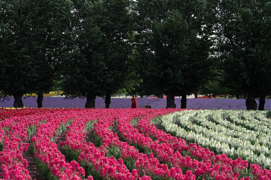
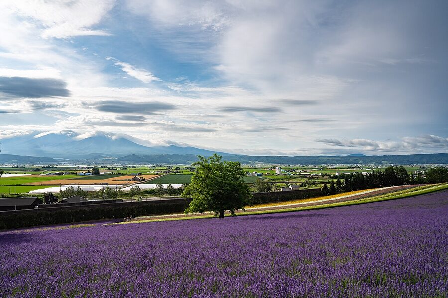
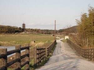
The classic Biei to Furano flat day
The day-trip ride almost everyone does goes: JR Biei station → Patchwork Hills loop → south on Route 966 to Shikisai-no-Oka → Panorama Road → Farm Tomita → finish at JR Furano station. Bike returns by train (yes, your rental shop will accept a one-way drop at Furano if you arrange it; most do). Total distance about 60 km, total elevation gain about 650 m, doable in a day at a tourist pace.
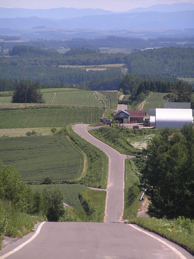
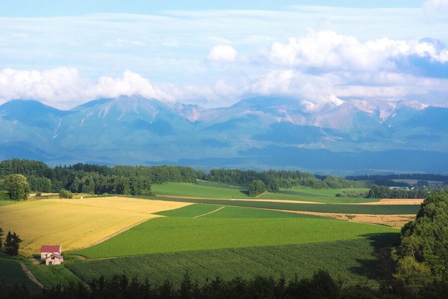
The ride breaks itself naturally into thirds. The first third (the Patchwork section) is 12-14 km of Biei farmland with a constant choice between the sealed Route 966 (faster but less photogenic) and the smaller agricultural lanes that wiggle between the named tree-photo spots. Take the lanes. Then comes the long sweep south through Bibaushi and into Kamifurano, which is the section everyone underestimates because the map looks flat. It’s not flat. It’s a series of long, gentle uphills that grind in the heat, and there are stretches where the only shade is whatever you brought with you.
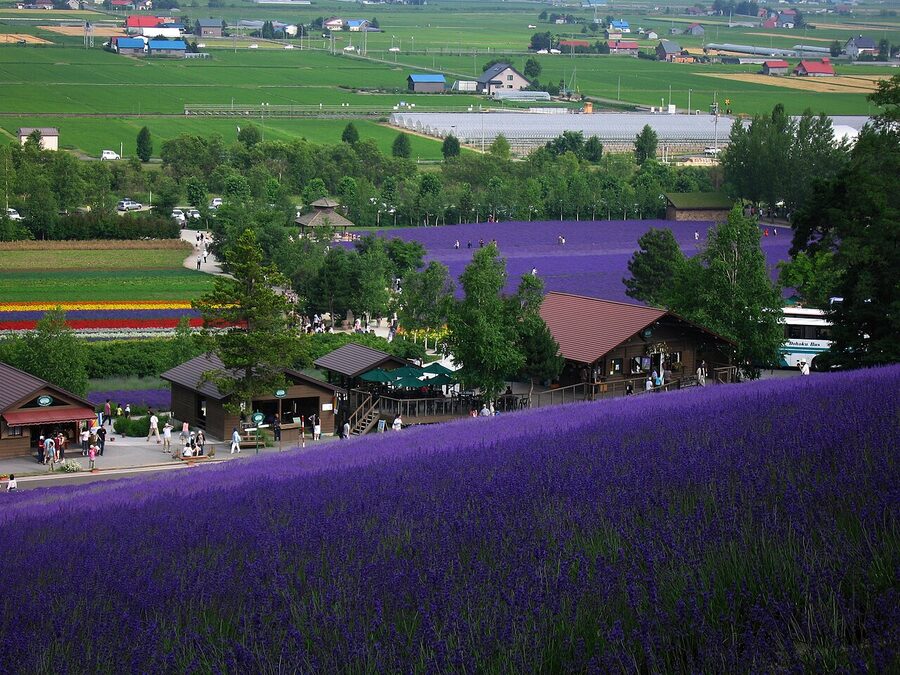
The third part is the lavender belt. Around km 40 you hit Shikisai-no-Oka, then it’s another 10 km on the Panorama Road into Nakafurano and Farm Tomita, then a final flat run to Furano station. By the time you reach Tomita you’ll be hot, slightly cooked, and ready to spend ¥500 on a lavender soft serve and not feel bad about it.
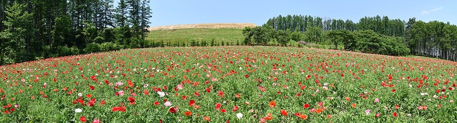
Shikisai-no-Oka and the Christmas Tree
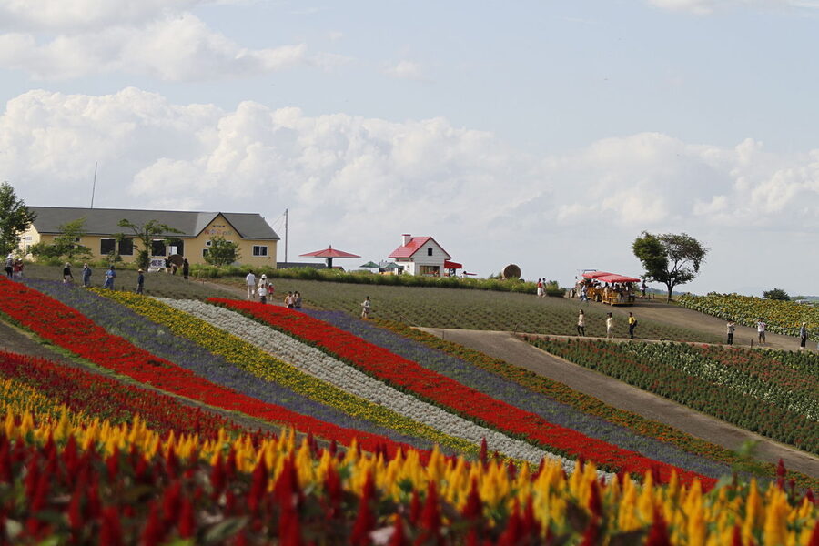
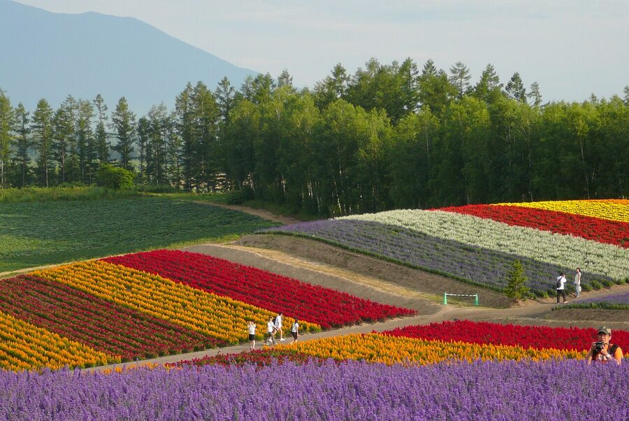
Shikisai-no-Oka is 15 hectares of staggered flower planting, with different blocks blooming in different weeks, so the panel of colour shifts week by week from late May (poppies, pansies) through July (lavender, lupins) and into September (sunflowers, salvias). Entry is free. The internal "buggy" (a tractor-pulled tourist cart) costs ¥500 and the alpaca enclosure another ¥500. Both are skippable on a bike unless you’re with kids. What’s not skippable: leave your bike at the rack, walk the highest path, then ride the loop on the small road that circles the place. From the road’s western edge you’ll see the planted hills better than from any of the official viewpoints, and you won’t be queueing.
The Christmas Tree (Kurisumasu Tsurii no Ki) is an eight-metre lone spruce in a field about three kilometres south of Shikisai-no-Oka. It’s not a long detour, the photo-op is what you’ve seen in every guidebook, and there’s nothing else there. Worth a stop, not worth a wait. If a coach has just pulled up, ride on. The Mild Seven Hill (a row of six larch trees that featured in a 1970s cigarette ad) is in the same direction and gets the same crowds.
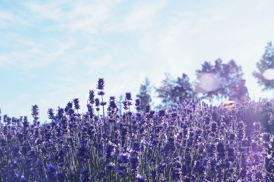
Farm Tomita: go at 06:00 or skip it
Farm Tomita is the famous one, the lavender farm that put the region on the international map. It’s free, the gardens are well kept, and the lavender peak is roughly 10 July to 25 July with shoulder weeks either side that are still good. The problem is everyone knows this. By 09:00 in season the car park has coach traffic, the soft-serve queue stretches for forty minutes, and the photogenic east field (ラベンダーEAST, a separate site reached by a free shuttle) has a one-way pedestrian system in place.
If you’re cycling, you have an unfair advantage: you can be there at first light. The farm is technically open all hours (the cafes and shops open at 09:00 but the gardens are unfenced) and the painted cycling route runs right past the entrance. Get in by 06:30, take your photos, eat the lavender soft serve when the cafe opens at 09:00, then leave. By 11:00 you’ll be fifteen kilometres south at Furano station and the queues will be someone else’s problem.
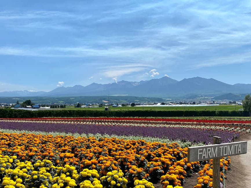
The melon-and-lavender soft serve is the one to get. It costs about ¥500. Yes, it sounds odd. Try it before you decide.
Roller Coaster Road
About four kilometres before you hit Tomita, the painted route swings east into Kamifurano and runs along Route 759, which the local council brands as the Roller Coaster Road. Three rolling crests, descents long enough to stop pedalling, a perfectly straight black ribbon disappearing into the Tokachi range. Tour buses don’t fit, motorbikes love it, and on a bicycle you’ve got the descents to yourself. Just remember the lift on the next one. Triple-check your descent speed, because the road dips into a couple of farm-track crossings where a slow tractor can be on the asphalt with no warning.
Blue Pond, Shirogane and the cycle path that opened in 2020
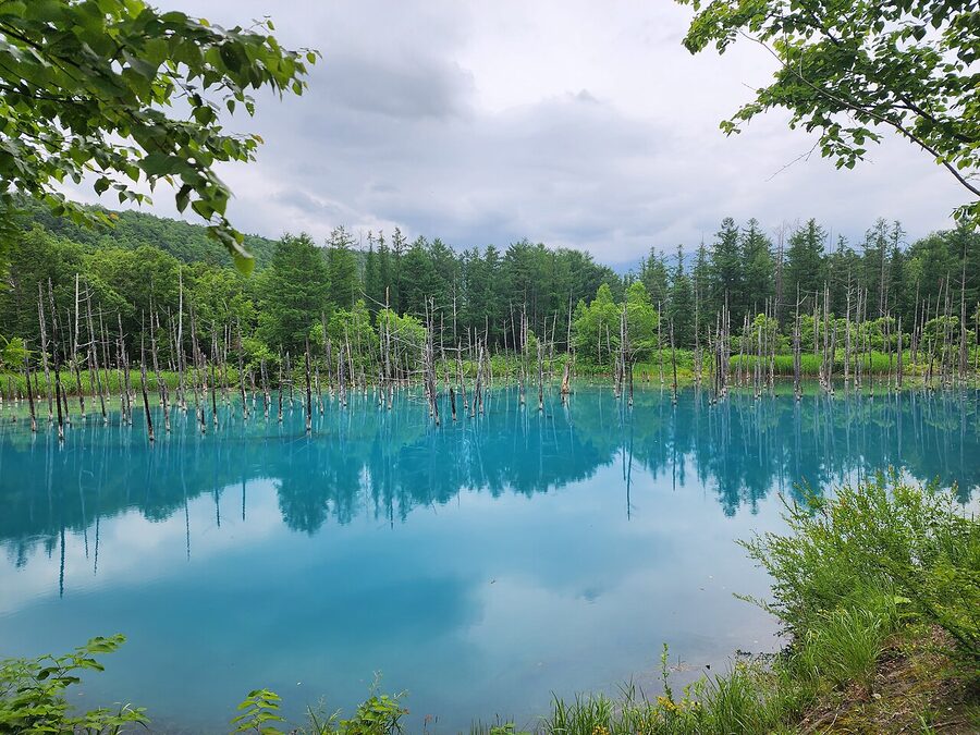
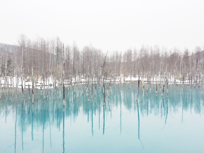
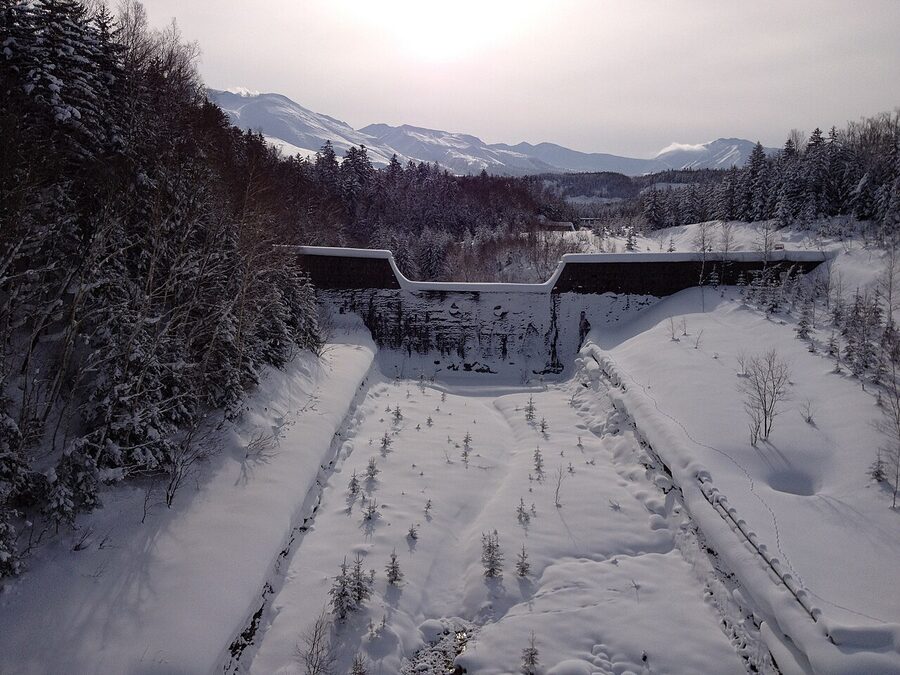
Aoi-ike (the Blue Pond) is the most photographed thing in Hokkaido after the Sapporo TV tower. It got famous because Apple shipped one of its photos as a Mac wallpaper in 2014, and it’s been packed ever since. The colour is real: aluminium hydroxide from the Shirogane hot springs upstream scatters short-wavelength blue light off the water. The dead trees standing in it are larch and spruce that were drowned when the Biei River was dammed in the early 1980s after Tokachi-dake’s 1988 eruption (the dam is a debris-flow precaution). It’s beautiful and it’s also ten minutes of looking before you’ve taken your photos and you’re done.
The good news for cyclists: the Aoi-ike is on a dedicated paved cycle path that opened in spring 2020. The path leaves Biei town centre on Route 966, joins the Biei River corridor, and climbs gradually for 18 km up to Shirogane Onsen and Aoi-ike beyond. According to the Biei tourism board it’s about a two-hour ride one way. With an electric-assist bike, knock 30-45 minutes off that.

Two unsung stops on the way up. Shirahige Falls (literally "white-beard falls") drops sideways out of a cliff right at the bridge above Shirogane Onsen, fed by groundwater seeping through the volcanic rock. The water is the same milky-mineral mix that turns the pond blue. There’s a free public viewing platform on the bridge and you can see the falls from your bike without dismounting. The other one is Shirogane Fudo-no-taki ("immovable falls"), about a kilometre below Shirahige and signed in Japanese only. It’s the better waterfall, in my opinion. Quieter, taller, and you can stand at its base. It’s about two minutes off the cycle path. Look for the small wooden post with 不動の滝 carved on it.
If you’ve got time, ride 800 m past the Aoi-ike turnoff to Shirogane Onsen and have a soak. Mori-no-Ryotei has a public bath open to non-staying day visitors for ¥1,000 from 13:00 to 16:00 most days. After the climb up from Biei, your legs will tell you that ¥1,000 is the bargain of the trip.
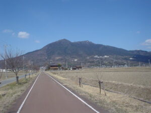
The Tokachi-dake hill climb
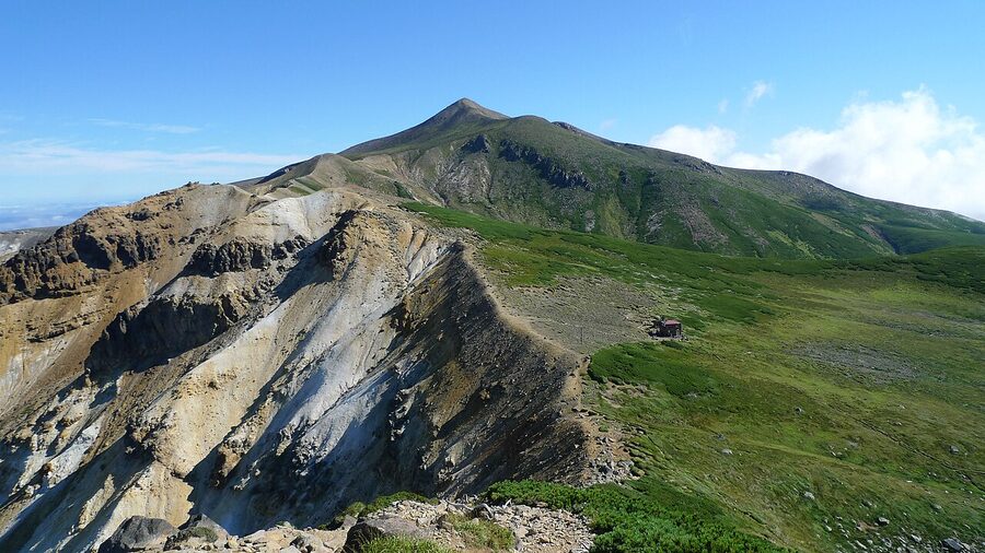
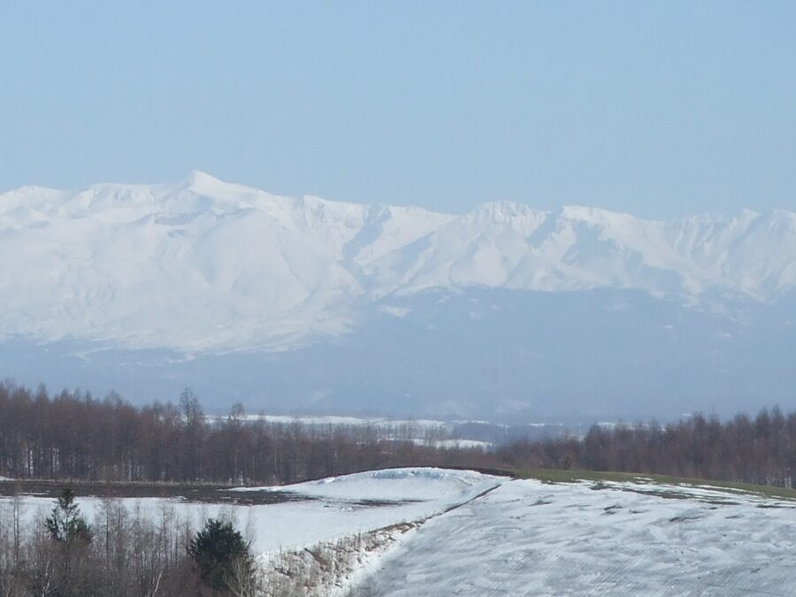
This is the section the English-language guides skip. From Kamifurano station the road heads east on Route 291 and starts climbing immediately. The first 7 km is gentle, 4-5% on average, through farms and gradually thinning forest. Then it kicks up. The last 7 km to Tokachi-dake Onsen averages 7-8% and the final two ramps hit double figures. Total ascent from Kamifurano station to the Ryounkaku Lodge at the top is around 1,000 m over 14 km, and you’ll feel every metre.
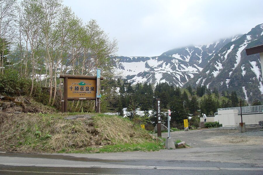
What you get for that effort: at 1,280 m elevation, Tokachi-dake Onsen is the highest hot-spring village in Hokkaido and on a clear day you’re looking down the spine of the Tokachi range. The most rewarding payoff is at Ryounkaku, the lodge whose name literally means "the cloud-cresting tower". The views from its outdoor bath are the kind that turn into the desktop wallpaper on your laptop the next week.
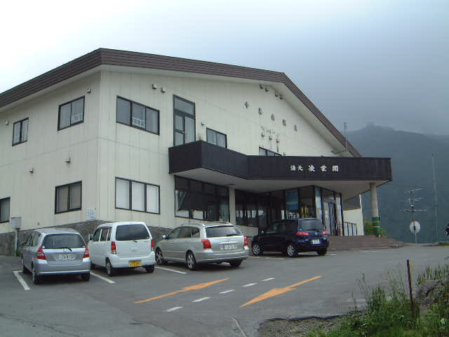
Below Ryounkaku and reachable by an easier turnoff is Hakuginso, same area, less famous, ¥600 day bath, communal kitchen if you’re staying overnight, ¥2,500 per person for a futon. There’s also Fukiage Onsen, an outdoor mixed-gender natural rotenburo (no cubicles, just a hot pool by the road). It’s free. It’s also exactly what it sounds like, so go in knowing.
If you’re climbing this, do it in a day with luggage stashed at your Kamifurano hotel. Drop most of your gear, ride up with water and a windproof, soak at the top, descend. Coming down takes about 30 minutes if you’re sensible. The descent is fast, the road has no escape lanes, and there are about three blind hairpins in the upper section. Do not bomb it.
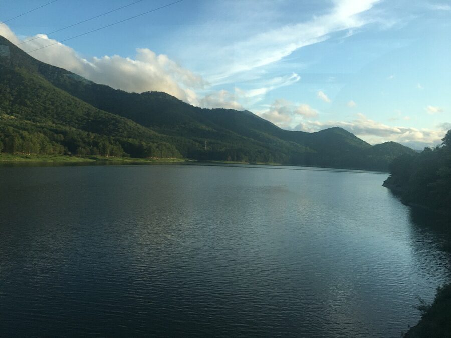
Route B: the southern lake route
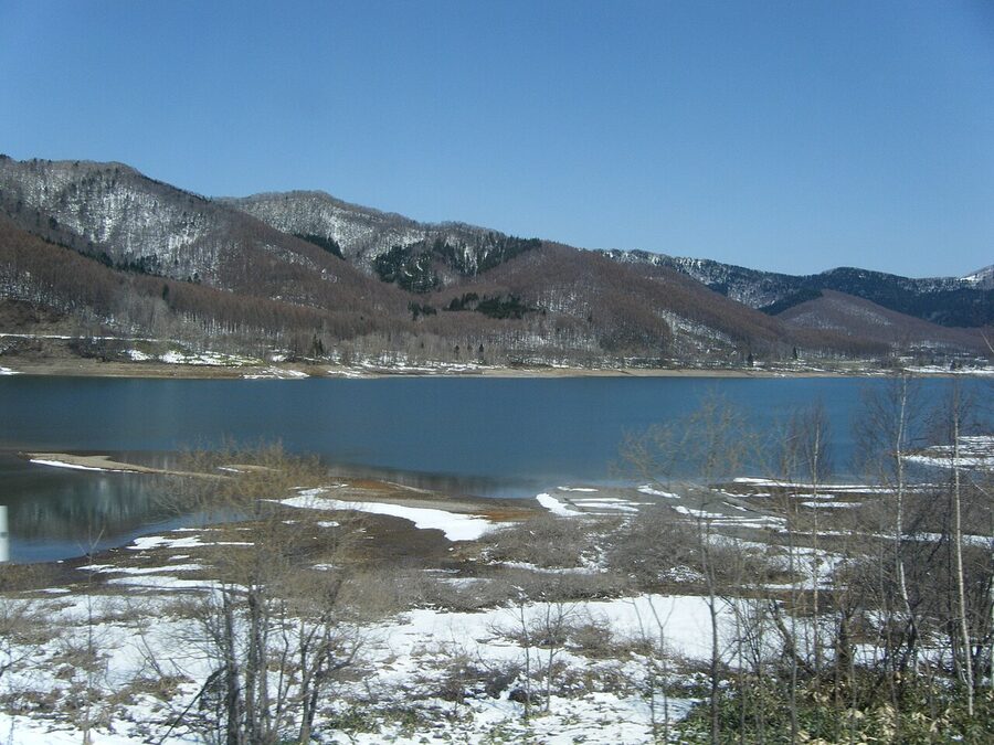
Route B leaves Furano going south, follows the Sorachi River for about 30 km, hits Lake Kanayama in Minamifurano, then loops east towards Shimukappu. The full 150 km splits naturally into two days, with an overnight at Lake Kanayama or in Shimukappu village. This is the part of the network the lavender tourists never see, and it’s the part I’d actually recommend if you’ve got three days and you’re a competent rider.
Two reasons to ride it. First, Lake Kanayama in itself: the lake is in a deep valley with forested ridges on both sides, almost no development on the water, and the 18-km Route C lap road runs through farmland and orchards on the southern side. Second, the gradients are mostly easy. Apart from one moderate climb out of Furano (the watershed at Hatakeyama Pass, around 3 km of 4-5%) the rest of Route B never gets steep. It does, however, get long. There are two stretches between Lake Kanayama and Shimukappu where you’ll go 15-20 km without seeing a convenience store. Plan accordingly.
The accommodation problem on Route B is real. Lake Kanayama has the campground and a public-bath inn, but otherwise the options are thin. If you’re not camping, book Hotel Naturwald in Shimukappu or one of the small minshuku in Minamifurano in advance. Walking up at 17:00 in July expecting a room is not going to work.
If long, mostly-flat Hokkaido riding is what you came for, you’ll find a similar feel on the Biwaichi loop around Lake Biwa in Honshu, although Lake Kanayama is rougher around the edges and considerably emptier.
When to ride
The cycling season is broadly mid-May to mid-October. Outside that you’ve got snow on the road, ice in the corners, and most rentals are closed.
- Mid-May to mid-June. Cool, very few tourists. The fields are green but the famous flowers haven’t bloomed yet. Cherry blossom comes through in early to mid May around Furano. Route A is easy and quiet. Route B is rideable but cold.
- Late June to mid-July. The first lupins, poppies and early lavender. Daytime around 22-25°C, perfect cycling weather, manageable crowds. My favourite window.
- Mid-July to early August. Peak lavender, peak everything else, peak crowds. Tomita can be unbearable from 09:00. The flip side: Shikisai-no-Oka is at maximum colour, the cycling weather is hot but bearable, and the volcanic peaks are mostly free of cloud.
- Mid-August to late September. Sunflowers, salvias, then the first autumn colours from mid-September. Crowds drop dramatically after Obon (around 15-17 August). One of the best windows for the Tokachi-dake climb because the air is clearer.
- October. Larch turns gold along the Biei River cycle path. Cold mornings, often 5-8°C at dawn. Most rental shops close around 20 October.
If your dates aren’t fixed, aim for the first or last week of July. You get peak lavender at Tomita and a window before the absolute peak crowds.
Rentals: where to actually go
The rental scene is overwhelming until you understand the basics. Most rental shops in Biei stock city bikes and electric-assist bikes. Most rental shops in Furano stock the same plus a few mountain bikes. Road bikes (properly geared, drop-handlebar machines) are rare in both places. If you want to do the Tokachi-dake climb on something lighter than a 20 kg city bike, you need to plan ahead.
Rates vary, but the going day-rate as of 2026 is roughly:
- City bike or single-gear granny bike: ¥200–300 per hour, or about ¥1,500 per day
- Electric-assist (e-bike): ¥600–800 per hour, or about ¥3,500 per day
- Road bike (Asobiya, Furano Nature Club, North Gear): ¥5,000–8,000 per day
Most shops close at 16:30 or 17:00 sharp, which is the single biggest tactical mistake foreign cyclists make. If you’re starting at the Biei station rentals at 10:00 and aiming for Furano, you’ve got 6.5 hours to do 60 km plus stops. That’s tight on a city bike in July heat. Start early or accept that you’re not finishing today.
Biei (the north end)
- Terashima Shoukai (寺島商会, 0166-92-2191): biggest fleet near the station. City bikes, MTBs, e-bikes, road bikes, electric cross. The road bikes go fast in summer, book ahead.
- Roadside Station Biei "Shirogane Birke" (0166-94-3355): the best place to start the Aoi-ike ride, because the rental is already 7 km up the cycle path. They have road bikes, e-bikes, kids’ bikes, and even fat bikes for winter.
- BIEI HILLS / 旧宇野商店 (080-3268-1141): a handful of e-bikes and city bikes, walking distance from the station, decent for half-day rentals.
Kamifurano (the climb start)
- Cafe Yamaichi (0167-45-3157): 12 cross bikes, 7 mountain bikes, also runs guided tours. The closest place to the Tokachi-dake climb start.
- Naganuma Bussan (0167-45-2417): 10 e-bikes and 4 city bikes, near the Kamifurano flower museum.
Nakafurano and Furano (the south end)
- Asobiya (遊び屋, 0167-22-0534): Furano’s serious-cyclist shop. 40 mountain bikes, e-bikes, guided tours. Will do same-day delivery to your Furano hotel for an extra fee.
- Furano Nature Club (0167-22-1311): MTBs, cross bikes, e-bikes, also runs guided rides up to Tokachi-dake.
- Northern Star Lodge in Nakafurano (0167-44-2081): 3 e-MTBs and 4 e-cross bikes, but rentals are guests-only and you must phone the day before.
Lake Kanayama (Route B)
- Minamifurano Tourism Association (0167-39-7000): 6 e-MTBs, 20 e-cross bikes. Guided tours of the lake. The only realistic option if you’re starting Route B from the south end.
- North Gear (090-7762-9771): road bikes, the only place at the lake end that hires drop-bar bikes. Phone in advance, the inventory’s small.
One trick worth knowing: if you’re staying in Asahikawa rather than Furano (Asahikawa is the main rail and bus hub for the area), the Asahikawa airport’s rental cycle service has e-bikes you can take on the airport bus to Biei. Confirm with the airport tourism desk on arrival.
Getting there from Sapporo or Asahikawa
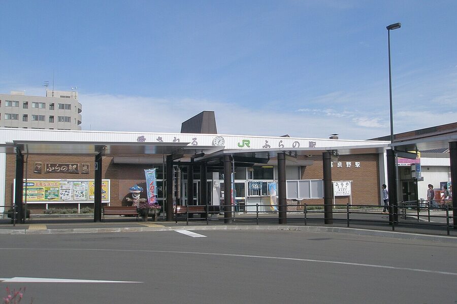
Asahikawa is the gateway. Nearly everyone arrives via Asahikawa airport (35 minutes from Sapporo by direct flight, hourly all day) or Asahikawa station (the Lilac limited express from Sapporo, around 90 minutes, ¥4,690 in reserved seat). From Asahikawa it’s the JR Furano Line south: 30 minutes to Biei (¥640) or 70 minutes through to Furano (¥1,290). Both stations have rentals within walking distance.
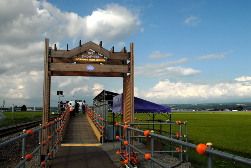
The Furano Line is the cyclist-friendly option for one specific reason: in the summer season (roughly 20 June to 20 August) JR Hokkaido runs the "Norokko-go" sightseeing train between Asahikawa, Biei, Lavender Farm Station and Furano. It has open-window carriages, runs at tourist-train speed, and stops at the seasonal-only Lavender Farm Station which is an 800-metre walk from the gates of Farm Tomita. With a folding bike or a bagged bike, it’s ideal for a one-way assist after a long day. Reserved seats sell out 30 days in advance in peak July; book through the JR Hokkaido site or any midori-no-madoguchi.
From Sapporo direct, the alternative is the Furano Bus highway service via Takikawa (around 2.5 hours, ¥2,500) but it doesn’t take bikes, so it only works if you’re renting locally.
Etiquette, the agricultural-land rule, and three things that will catch you out
The Biei tourism board has been begging foreign cyclists for years to stay on paved roads. The reason is bacterial: the soles of your shoes and the tyres of your bike carry pathogens that can ruin a season’s worth of potatoes or wheat for a farmer. There’s a polite warning on every rental form. Treat it as the law of the land. If a track isn’t on the map, it’s a private agricultural lane. Stay off it. Don’t pose for "artist among the wheat" shots in the field. The locals genuinely hate it, and they’re right to.
Three other things worth knowing.
Stop signs are triangular. Japan uses a red-white triangle pointing down with 止まれ (tomare) painted on the road, not the international red octagon. Treat them like the international stop sign: full stop, look, then go. Police do enforce this, and Hokkaido drivers don’t expect cyclists to roll through.
Tractors have right of way on rural lanes. If a combine harvester is behind you on a single-lane farm road, pull off and let it pass. The farmer is not on a leisure ride. Smile and wave, then go.
Cycle racks are at every Seicomart convenience store. Seicomart is Hokkaido’s local convenience-store chain (the one with the orange-and-yellow logo). They’ve installed cycle racks at most rural locations and many will lend you a track pump if you ask. You’ll see them every 10-15 km along Routes A and B. They’re better stocked for cyclists than the more famous chains. The Seicomart hot-counter pork katsu sandwich is a perfectly acceptable lunch.
If you have a flat or a chain comes off and you’re outside mobile reception (which happens on the Patchwork Hills and on Route B’s lake stretch), the Biei Tourism Association takes calls on 0166-92-4378 and the Furano-Biei council can mobilise a courtesy pickup if you’re really stuck. They’re less keen on it than they used to be, but it’s there.
Where to sleep
For a one- or two-night trip, base in either Furano (more nightlife, cheaper inns) or Biei (smaller, sleepier, prettier). For three days or more, split between the two.
In Biei, the budget option is the Biei Potato Hostel (around ¥4,500 per night for a dorm bed, friendly to cyclists, lockable storage, basic kitchen). Mid-range is Pension Hokuseinooka (¥9,000-12,000 with breakfast), a small inn near Maruyama where the owner used to ride the Patchwork loop daily. The high-end pick is Lavenir (0166-92-5555), which doubles as a rental shop and has secured indoor cycle storage.
In Furano, La Vista Furano Hills is the upmarket choice (around ¥18,000 per person with breakfast and onsen) and has secure indoor parking for bikes. Hostel Tomar near the station is the budget option (¥3,300-4,500), modern, runs a bike-room downstairs. The Naturwald complex in central Furano is a step up from the hostel and lets you walk to the dinner-and-drinks block of restaurants, which there isn’t much of further north.
For Route B, the Lake Kanayama campground is ¥500 per pitch with showers and a well-run common kitchen. Hakuginso Lodge near Tokachi-dake Onsen is ¥2,500 per person with shared tatami rooms and the volcano-fed bath I wrote about earlier. If you want something fancier near the lake, Hotel Naturwald in Shimukappu is the only real option and it books out weeks ahead in summer.
What to ride elsewhere if you’ve enjoyed this
Furano-Biei is good in a particular way that nothing else in Japan really matches: open agricultural country, paved cycle path, signed at every kilometre. The closest experience for foreign cyclists is the Shimanami Kaido in the Seto Inland Sea, which has the same painted-on-asphalt navigation but on islands and bridges instead of farmland. Shimanami is more spectacular per kilometre; Furano-Biei is quieter and more about being inside a landscape than crossing one.
For long, easy days on a single big body of water, the Biwaichi loop around Lake Biwa in Shiga is the natural next ride. It’s 200 km, mostly flat, and shares the Furano-Biei feel of empty roads and signed routes. Different scenery (temple gates and reed beds rather than lavender), same bones.
If you want a complete contrast, look at the Tobishima Kaido, Shimanami’s much quieter sister route through the islands east of Hiroshima. Or for something epic and traffic-heavy in places but rich in history, the Tokaido coastal route from Tokyo to Kyoto follows the old Edo highway with castle towns and post stations every 20 km.
For a more compact island ride that you can do in two days, the Awaichi loop on Awaji Island in the Seto Inland Sea covers 150 km of coastal road with much warmer climate than Hokkaido and a softer winter shoulder. Different vibe, similar appeal.
For practical questions about cycling in Japan generally (visa rules, train rules with bagged bikes, road etiquette, helmet requirements, what counts as a road-legal bike), the cycling Japan FAQ answers most of them.
One final practical thing
Tokachi-dake is an active volcano. It hasn’t done anything dramatic since 1988 but the smoke plume above the upper crater is real. The Japan Meteorological Agency keeps it at Level 1 (normal) most of the time but can raise it without warning. If you’re climbing the road, check the JMA volcanic-alert page the morning of your ride. If the level is at 2 or above, the upper road past Bogakudai is closed and there’s no point starting the climb. The Aoi-ike and Shirogane sections are unaffected and still rideable.
Pack a layer for the descent. Even in August the wind chill at 1,200 m at 50 km/h coming down off Tokachi-dake will get into your bones in five minutes. A cheap cycling gilet from any Asobiya rental kit will do.
And take the Norokko train back if you can. It’s a slow, open-window summer service, the carriages smell of lavender soap because the staff sell it from a trolley, and after a long ride sitting still while the same scenery rolls past at 30 km/h is one of those small Japanese pleasures that you can only really get once.
.jpg)
.jpg)
.jpg)
.jpg)
.jpg)
.jpg)
.jpg)